
Ancient Civilizations / World Maps BUNDLE- Color & Label Activities!


- Zip
What educators are saying
Products in this Bundle (8)
showing 1-5 of 8 products
Also included in
 Humans love coloring- tap into your students' interests and apply it to your Social Studies and Geography lessons! 21 different map activities are available and cross many different social studies topics- like American History or Ancient Civilizations. All maps are completely student-centered andPrice $27.99Original Price $37.89Save $9.90
Description
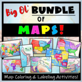
This maps bundle offers a creative way to learn about the geography of the Ancient World! Each student will make their own, personalized maps of different global civilizations, and enhance their knowledge of each region. They will label and color their blank maps, and answer follow-up questions related to the geography of each civilization, and create fun travel brochures. This includes a world map of continents and oceans. These activities are completely student-centered, and no direction instruction is needed.
Directions and follow-up activities are provided in Google Drive/Classroom, but- **blank maps should be printed.
The money that you save by purchasing this bundle is comparable to getting almost THREE of the map resources for FREE!
Included:
- 8 Blank Maps
- 8 Map Directions sets (with suggested colors to use)
- 7 worksheets with five engaging follow-up questions, and 1 worksheet (for the World: Continents and Oceans map) with a "Test Your Skills" assessment!
- 8 Completed, colored maps to use as a guide
- 7 "Make a Travel Brochure" activities! (All maps except 'Continents & Oceans')
Topics Covered:
- ANCIENT ROME
- ANCIENT GREECE
- EGYPT
- CHINA
- MESOPOTAMIA
- INDIA
- ISRAEL
- WORLD: Continents and Oceans
Check out this MESOAMERICA MAPS BUNDLE to further enhance your students geographic knowledge!
*Want to add a bunch of Student-Centered, Google Compatible Ancient Civilizations resources? Well then you may like this Ancient Civilizations Bundle! (the same maps in this resource are included in the Ancient Civilizations Bundle!)
*Add a Geography Scavenger Hunt about the Ancient Civilizations!
Thanks, and please provide feedback! Simply go to "My Purchases" in your account, find this resource, and click the text to provide feedback. Benefits? You get TpT $$ to use toward future purchases, and I get info. that is helpful for potential buyers. It's a win-win!
