
Central America and the Caribbean Mapping Activity


- Word Document File
What educators are saying
Also included in
 This product is all of my political and physical geography maps in one easy download! Currently there are 13 maps included in this bundle: (more may be added and you will be notified of the update of the product)Physical Features: World Mapping ActivityCanada Mapping ActivityLatin America Mapping AcPrice $22.00Original Price $28.00Save $6.00
Description
This product is a mapping activity on the region of Central America and the Caribbean. Students will label and color 26 different countries and territories as well as draw and label major physical features.
When students have completed the map they will then answer 10 questions based on their map.
This product also contains a blackline political maps of the region. I typically make the map a 11x17 making it easier for students to label countries and physical features.
This is a rigorous map project that makes the students learn where countries and physical features are in the region of Central America and the Caribbean.
Check out the preview for a peak at what the students will learn!
Thanks for looking.
Enjoy!
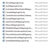
Other Mapping Activities you may like:
Physical Features: World Mapping Activity
Latin America Mapping Activity
United States Mapping Activity
Middle East Region Mapping Activity
Australia and New Zealand Mapping Activity
North Africa, Southwest Asia & Central Asia Mapping Activity
Sub-Sahara Africa Mapping Activity
