
Continents and Oceans Maps and Posters | Geography and Maps Word Wall


- PDF
What educators are saying
Also included in
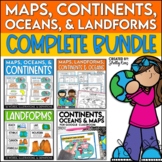 This Social Studies bundle includes the best-selling Maps, Continents, and Landforms Interactive Notebook, along the coordinating word wall posters! Students and teachers love the ease of the hands-on printables, worksheets, and digital activities of this complete bundle!By purchasing this bundle, yPrice $12.80Original Price $16.00Save $3.20
Description
Continents and Oceans and Map Skills can be fun to teach, especially when you have this great set of word wall cards. Each card includes the word, definition, and a clear, colorful illustration. Make a great bulletin board in just minutes!
Click HERE to save 20% with the Continents, Oceans, and Map Skills BUNDLE!
Please click on the PREVIEW above to get a clear picture of everything included.
PERFECT for visually reinforcing landform vocabulary!
This helpful continents, oceans, and maps word wall set includes 36 vocabulary posters:
Africa
Antarctica
Asia
Australia
Europe
North America
South America
Arctic Ocean
Atlantic Ocean
Indian Ocean
Pacific Ocean
Southern Ocean
Eastern Hemisphere
Western Hemisphere
Northern Hemisphere
Southern Hemisphere
Equator
Prime Meridian
Tropic of Cancer
Tropic of Capricorn
Arctic Circle
Antarctic Circle
Latitude
Longitude
Compass Rose
North
South
East
West
Northwest
Northeast
Southwest
Southeast
South Pole
North Pole
This Continent, Oceans, and Maps Word Wall set is a perfect companion to Interactive Social Studies Notebook - Maps, Continents, & Landforms
AND
my Landforms Word Wall Cards- Words, Definitions, and Pictures.
Don't forget that leaving feedback earns you points toward FREE TPT purchases. I love that feedback!
Also, FOLLOW ME and be notified when new products are uploaded. New products are always 50% off for the first 24 hours they are posted. It pays to follow me!
As always, please contact me with any questions!
Thank you so much,
Shelly Rees
