
Islam Map Worksheet | Google Classroom | Printable & Digital


- PDF
What educators are saying
Also included in
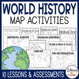 Engage students in active learning using map lessons! The following TEN map lessons are included with this product: The World; Roman Empires; The Rise and Spread of Islam; The Maya, Aztec, and Inca Empires; Medieval Japan; Medieval China; Medieval Africa; Medieval Europe; The Reformation; and RenaiPrice $23.00Original Price $29.25Save $6.25
Description
This map lesson and assessment focuses on the rise and spread of Islam between 632CE and 750CE. Students will analyze how geography and trade played an important role in the spread of the Islamic Empire. A digital version is included for use in your Google Classroom.
**This resource is part of the World History Map Activities Bundle. TEN map lessons and assessments are included at a 20% discount price! Click here to see all the resources in the bundle and take advantage of the HUGE savings.
INCLUDED WITH YOUR PURCHASE:
- Map Directions and Questions: The comprehensive map directions require students to locate and label rivers, bodies of water, cities, and the areas controlled by Islam between 632-750CE. The directions are written for students to be able to follow independently and complete at their own pace. Questions are also included for students to answer using their completed map.
- Black Outline Map: Students will need colored pencils to complete the map and key (if completing the paper version). Ideally, students will use their completed map when taking the assessment.
- Color Reference Map: The reference map provides a visual representation of what the finished map should look like. It can also serve as a reference for students when completing their own map.
- Map Assessment: The assessment requires students to use their completed maps to match geographic locations relating to the spread of Islam.
- Map Assessment Answer Sheet: An answer sheet is provided for students to record their responses. Two answer sheets fit on one page for less copying.
- Answer Keys: An answer key is provided for the map questions and assessment.
This resource can be printed or accessed online with laptops, Chromebooks, tablets, or any device that supports Google Slides. The included Teacher's Guide includes access to the links that will allow you to make your own copy of the resources for use in Google Classroom/Google Drive.
Additional World History Map Lessons:
Medieval Japan Map Lesson and Assessment
Aztec, Maya, & Inca Map Lesson and Assessment
Medieval Africa Map Lesson and Assessment
Want a FREE resource each month? Click HERE to follow Literacy in Focus, and you will be sent the monthly freebie!
Thank you!
©Literacy In Focus
