
Japan Geography YouTube Video Graphic Organizer Notes Doodle Style Worksheet


- PDF
- Google Apps™

What educators are saying
Also included in
 This bundle includes all seven graphic organizer sets with a Google ready graphic organizer option for distance or remote learning! These fun doodle-note-themed graphic organizers are used with a free, engaging Whiteboard Animation Style YouTube video created by Instructomania. The video series covPrice $18.20Original Price $28.00Save $9.80
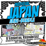 Skills+Creativity+Accountabilty! Get everything you need with all of the Feudal or Medieval Japan History lesson content essentials in one new, low-cost, stellar mini-bundle! Whether you are a new teacher or just need to freshen up your content, this mini-bundle combines our most popular items withPrice $12.00Original Price $20.79Save $8.79
Description
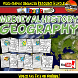
Teach the geography of Medieval Japan with an interactive video made just for middle schoolers. This can be done as a class or individually. In this map activity, students will learn about the key geographical features of Medieval Japan in an easy-to-use video and accompanying worksheet! The video series can be located at:
Medieval History Geography Videos
What's included:
✓ A two-page mini-lesson either displayed with teacher direction or done on Google Chromebooks
✓ A one-page student-centered graphic organizer that requires little teacher direction. This a perfect sub plan!
✓ An exit ticket geography fact summary slip to be handed to the teacher when students are headed out the door
✓ An answer key
Each video 8-10 minutes long and divided into three sections. Students do all of the following:
►Learn about and map the key geographical features of Japan
►Play a fun game that has students track an animal on the map and reveal its final destination in the region
►Discover how geography shaped the lives of the people. Students support a claim with evidence from the geography video
►Learn about the types of people who lived in the civilization
This activity can be done individually in a Google 1:1 classroom or as a class via projector. Your students are guaranteed to love it!
➖➖➖➖➖➖➖➖➖➖➖➖➖➖➖➖➖➖➖➖➖➖➖➖➖➖➖➖➖➖➖
Our World History Curriculum, including Ancient History lessons and Medieval History lessons, are key-concept based, focussing on the “big six” key concepts for social science, often referred to as GRAPES. By learning World History with key concepts as a filter, students will become familiar with the crucial attributes that have allowed ancient and medieval civilizations to prosper. Also, students will build a framework, scaffolding future learning with the key concepts that will be repeated throughout their academic careers.
Each unit comes with notes, graphic organizers, and review worksheets that have the GRAPES key concepts in mind:
- G= Geography
- R= Religion
- A= Achievements
- P= Politics/Government/Leadership
- E= Economy
- S= Social Classes
➖➖➖➖➖➖➖➖➖➖➖➖➖➖➖➖➖➖➖➖➖➖➖➖➖➖➖➖➖➖➖
⇒ Be sure to FOLLOW us on:
⭐ TPT to receive notifications of new products, sales, and notes to followers. Just click the “follow me” button next to the ⭐
✅Pinterest for creative classroom ideas, lessons, and more.
✅Instagram for laughs and to see products at use in the classroom.
✅Facebook for interesting articles, posts, & tips!
✅ Check out ourwebsite & blog</a>
➖➖➖➖➖➖➖➖➖➖➖➖➖➖➖➖➖➖➖➖➖➖➖➖➖➖➖➖➖➖➖
❤️❤️❤️About Mr. and Mrs. P, the teachers behind Instructomania:
We are a Middle School teacher duo with over 40 years of experience in the Middle School classroom! We strive to create history and science lesson plans that inspire teachers and engage students, focusing on history activities for sixth, seventh and eighth grade. Our Ancient History and Medieval History curricula includes no prep worksheets and Common Core lessons that have been tested and polished in the classroom. World History activities are created with visually rich graphic organizer worksheets and fun thematic assignments. We hope you and your students love our products as much as we did making and using them in our Middle School classes!
➖➖➖➖➖➖➖➖➖➖➖➖➖➖➖➖➖➖➖➖➖➖➖➖➖➖➖➖➖➖➖
Terms of Use ☺
©Instructomania, Inc. All rights reserved by Tony and Erika Pavlovich. This product is to be used by the original downloader only. Additional teachers must purchase their own licenses. If you are a teacher, principal or district interested in purchasing several licenses, TPT now offers multiple license options.
