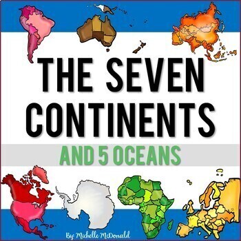
Seven Continents & Five Oceans Unit: Slide Shows, Reading, Activities, & More!
- Zip
- Google Apps™

What educators are saying
Description
Need an easy to use comprehensive resource for the major landmasses and oceans of the world? This social studies unit is packed full of facts, features, differentiated reading passages and comprehension questions, a research 3D globe craft, a collaborative poster for your hallway display, and much more to help you bring the seven continents and five oceans to life! Find everything you need all in one place!
Click the Preview to View More
This unit includes:
- Continents Facts & Features Slide Show
- Five Oceans Facts & Features Slide Show
- Informational Continents Mini Book (15 pgs.)
- Continents Audio Book (MP4 read along with highlighted text)
- 5 Oceans Flip Book (3 versions)
- Reading Passages & Comprehension Questions for each continent
- 3 Differentiated Reading Levels
- Answer Keys Included for All Reading Passages
- Label the Map Worksheets
- Name the Continents & Oceans Activity
- Fact vs. Opinion Sorting Activity
- Label the Compass Rose
- Continents Song
- Globe Craftivity (research & writing project)
- Writing Prompts
- Pocket Chart Cards
- Bulletin Board Display
- Collaborative Poster (3 sizes)
- Assessments (matching & true/false)
PRODUCT DESCRIPTION
Continents: Facts and Features Slide Show
- Slide Show with key facts and features for each continent is included
- Each continent is highlighted on the world map
- A collage of photos is included for each continent to give your students a glimpse of some of these features
- You can also print the slides and use as station information or create a wall display
Oceans: Facts & Features Slide Show
- This slide show covers the 5 oceans of the world
- Facts and features are presented for each ocean
- This slide show also covers the origin of ocean names
Continents Informational Mini-Book (Print & Digital)
- 15-page mini book that coincides with the facts and features slide show
- Students fill in the blank, answer questions, and illustrate pictures for each of the continents
- Keep your students engaged and on target
- Google slides version provides students an opportunity to conduct online research about each continent
Mini Book With Video Read-Aloud (MP4 Audio Book)
- MP4 video read-aloud file
- Printable booklet included
- Each sentence is highlighted in the book so that students can follow along as the book is read aloud
- Great for Listening to Reading centers
Oceans Flip Book
- 3 flip book differentiated versions included
- Students compile information in their flip books as they learn about the 5 oceans
Reading Passages & Comprehension Questions
- 50 pages of reading passages
- 3 differentiated versions
- Comprehension questions included
- A separate reading passage is included for every continent
- Levels I & 2 are single-page reading passages
- Level 3 is a two-page reading passage
- Print and digital options
- Please note that informational text generally includes vocabulary or key terms that may be higher than grade level
- ANSWER KEYS included!
3D Globe Craft
- Create a 3D globe craft about the seven continents
- Each section of the globe has a spot for your students to include information about each of the continents
- A great way for students to show what they know
- Single and double-lined options included
Cardinal Directions & Lable the Map Worksheets
- Printable worksheets to practice cardinal directions
- Label the continents worksheets
- Label the oceans worksheets
- Pocket chart cards are included that can be placed on your classroom walls to mark North, South, East, West
Continents Song
- Memorize the continents through a fun song
- Printable poster and student song sheets included
Writing Prompts
- Writing paper with several prompts are provided in this unit
- This resource includes both single-line and triple-lined paper to meet your classroom needs
Fact vs. Opinion Activity
- Students read the sentence card about the 5 oceans and determine if it is a fact or an opinion
- In the digital version, students drag and drop the cards to the correct category.
- Great for centers or independent work
Name the Continent Activity
- Students will identify the continent based on its shape
- In the digital version, students will identify the continent and drag and drop the correct label
- Great for centers or independent work
Collaborative Poster
- Each student colors their own section of the poster
- 3 sizes (18 pieces, 24 pieces, or 32 pieces)
- Perfect for a hallway display or bulletin board
- Great entry task or extension activity
Bulletin Board Display
- Bulletin Board Header "The Seven Continents" in several styles
- Enlarged continent outlines in color and backline are included
Pocket Chart Cards
- North America
- South America
- Europe
- Africa
- Asia
- Australia
- Antarctica
- Pacific Ocean
- Atlantic Ocean
- Arctic Ocean
- Indian Ocean
- Southern Ocean
- North
- South
- East
- West
- Color and Blackline included
Assessments
- Seven continents assessment
- Five oceans assessment
- Each assessment includes matching, and true/ false
- Several of the other map worksheets provided can also be used as an assessment tool
Please be sure to check out the preview for a closer look!
Thank you!
Michelle McDonald, B.A.E.
Social Studies Education, K-12
Elementary Education K-8
* * * * * * * * * * * * * * * * * * * * * * * * * * * * * * * * * * * * * * * * * * * * * * * * * * * * * *
Connect with Me:
Instagram: @mrsmcdonaldsclassroom
Website: www.StrategicEducationalServices.com
Facebook: Michelle McDonald
Consider following me on TpT to be the first to know about new products, sales and discounts. Follow Michelle McDonald


