
Silk Road: Virtual Field Trip with 8 Location Stops (Google Earth Exploration)


- PDF
- Google Apps™

What educators are saying
Also included in
 This virtual field trip bundle is a great way to infuse technology, spark curiosity, and bring the history and geography of China to life! Using a combination of Google Earth™ 360-degree views, informational text, video, and visuals, your students will learn about and explore Ancient China from variPrice $15.40Original Price $22.00Save $6.60
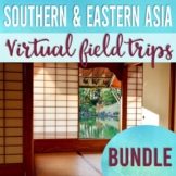 This virtual field trip bundle is a great way to infuse technology, spark curiosity, and bring the history and geography of Southern and Eastern Asia to life! Using a combination of Google Earth™ 360-degree views, informational text, video, and visuals, your students will learn about and explore thePrice $44.80Original Price $56.00Save $11.20
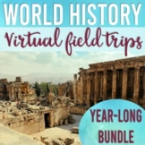 Infuse technology, spark curiosity, integrate critical thinking skills, and bring in multiple perspectives with this year-long virtual field trip bundle! Using a combination of Google Earth™ 360-degree views, informational text, video, and visuals, your students will have an opportunity to lead theiPrice $109.40Original Price $138.25Save $28.85
Description
Take your students on a virtual tour and make 8 stops along the Silk Road! Using a combination of Google Earth™ 360-degree views, informational text, video, and visuals, your students will learn about, explore, and better understand the history, geography, and significance of the Silk Road trade network.
The 8 Silk Road Stops Include:
:: Xi'an, China (Chang'an) (City Wall)
:: Dunhuang, China (fortification, Mogao Caves)
:: Tash Rabat, Kyrgyzstan (caravanserai)
:: Samarkand, Uzbekistan (Registan Square, Chorus trading dome)
:: Sahr-e- Qumis, Iran (analyze textile fragment)
:: Tyre, Lebanon (Phoenician city ruins)
:: Constantinople, Turkey (Golden Horn, Galata Tower)
:: Rome, Italy (Portus, Ostia Antica)
This Virtual Field Trip Includes:
:: Informational Text (build background knowledge)
:: Map Skills Activities Integrated (answer key included)
:: Video Links
:: Response Questions (EDITABLE)
:: Google Earth Links to 360-degree views
:: Grading Rubric
:: Everything is set up in Google Slides & ready to go!
How it Works:
This virtual field trip can be conducted teacher-led or shared with students through Google Classroom as an independent assignment. Everything is set up for you. This resource is LOW PREP and would even make great sub plans. Student directions are found within the lesson, and direct links are included to specific Google Earth™ locations. All work is completed digitally. No printing necessary.
Structure:
This virtual field trip is structured. This means that the informational text and links are meaningful and are meant to lead students to think critically as they respond to the questions throughout the virtual field trip. Map skills are integrated. This is also a great way to keep students accountable as they learn and explore. All response questions are EDITABLE, so you can tailor to your class needs.
Standards Alignment:
:: Common Core Standards for Reading Informational Text
:: Washington State Social Studies Standards for 6th grade World Civilizations.
:: California 6th Grade World Civilizations Standards
Grading Rubric & Answer Key:
A grading rubric is included which assesses: accuracy, thoroughness, validity, and writing conventions. Answers will vary throughout, as students are recording their observations and findings. I have also included an answer key for all of the mapping activities so that you can quickly assess student work.
Technology:
Please note that students will need to access Google Earth™ to complete this assignment. Google Earth™ can be accessed on a desktop using Chrome as the browser. If using a tablet or smartphone, simply download the Google Earth App before starting the virtual field trip.
If you have questions, feel free to reach out prior to purchasing. Looking for another virtual field trip that you don’t see? Let me know! I can be reached directly by email at: michellemcdonald9515@gmail.com
Thank you!
Michelle McDonald, B.A.E.
Social Studies Education, K-12
Elementary Education K-8
* * * * * * * * * * * * * * * * * * * * * * * * * * * * * * * * * * * * * * * * * * * * * * * * * * * * * *
Connect with Me:
Instagram @mrsmcdonaldsclassroom
Facebook: mrsmcdonaldclassroom
Blog: StrategicEducationalServices.com
* * * * * * * * * * * * * * * * * * * * * * * * * * * * * * * * * * * * * * * * * * * * * * * * * * * * * *
Follow me on TpT to be the first to learn about new products, sales, and discounts. Follow Michelle McDonald
