17 results
Geography interactive notebooks for SMART Notebook
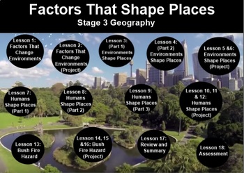
FACTORS THAT SHAPE PLACES- Stage 3 Geography (2 Terms inc. Proj.Bas.Lrn. + test)
My store- The Right Stuff, is primarily stocked with units which are used on the Smart Board. They are SMART NOTEBOOK files, and absolutely REQUIRE you to have this program available to you.This unit covers 2 full terms lesson material strictly adhering to the Australian Curriculum (NSW). You will find all information, worksheets, and web links included, as well as a written assessment. There is no answer sheet as answers are subjective to what students recall from the lessons.The outline is inc
Subjects:
Grades:
5th - 6th
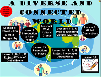
A Diverse and Connected World Two Terms’ Work- Geography, Stage 3
My store- The Right Stuff, is primarily stocked with units which are used on the Smart Board. They are SMART NOTEBOOK files, and absolutely REQUIRE you to have this program available to you.This unit covers 2 full terms lesson material strictly adhering to the Australian Curriculum (NSW). You will find all information, worksheets, and web links included, as well as a written assessment. There is no answer sheet as answers are subjective to what students recall from the lessons. Some links may re
Subjects:
Grades:
5th - 6th
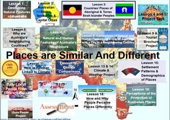
Places Are Similar and Different. Stage 2 Geography- 2 terms plus assessments
My store- The Right Stuff, is primarily stocked with units which are used on the Smart Board. They are SMART NOTEBOOK files, and absolutely REQUIRE you to have this program available to you.This unit covers 2 full terms lesson material strictly adhering to the Australian Curriculum (NSW) outcomes and indicators for this topic. You will find all information, worksheets, and web links included, as well as two written assessments that students can do by simply answering questions from the screen in
Subjects:
Grades:
3rd - 4th
Me on the Map, Map Skills and Main Idea Smartboard Unit
(This is an extension on my other Maps Unit- its the same but incorporates ELA standards of Main Idea and details). This was created by our first grade team to align with the common core standards for first grade. This smartboard file contains an entire unit plan for map skills (3-4 weeks)! It starts out introducing features of a map (symbols, map key, compass rose, cardinal directions, etc.) There are links to read aloud books you can use from the website Pebble Go, BrainPop Jr. and Bookfli
Grades:
K - 2nd
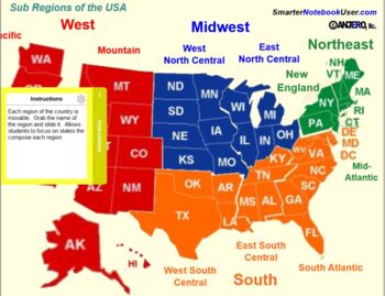
United States Regions - Geography
Regions of the United States - Smart Lab Activities. This Smart Notebook contains 8 interactive pages to help students learn and categorize the states that compose the regions and sub-regions of the United States according the the 2000 US Census Regions and Divisions Map. These pages are:This Smart Notebook contains 8 interactive pages to help students learn and categorize the states that compose the regions and sub-regions of the United States according the the 2000 US Census Regions and Divi
Subjects:
Grades:
5th - 6th
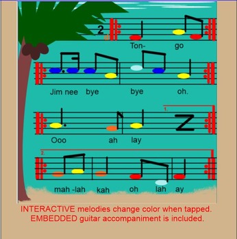
TONGO ~ Polynesian Folk Song~ Timka~ Low so~ Pentatonic~SMARTboard
Brought to you by Kodaly Music with Mrs Perry, this fun 'echo' song is great for teaching low so or timka. Included are 10 pages that allow you to teach one or the other. Read on to see what you get with this purchase:
*BACKGROUND - The name "tongo" is explained, as is what a mangrove is, as well as it's importance.
*MAPS - There are 4 clickable maps that zoom in on the Solomon Islands, Polynesia, where this song is from. You can relocate the star to indicate your school's location.
*PREP
Subjects:
Grades:
3rd - 6th
Types:
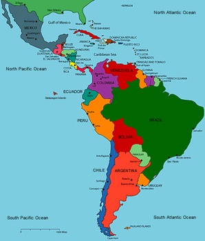
Latin America
Latin America - Social Studies SmartNotebook file to be used to study the three regions of Latin America. Used to explore Central America and Mexico, South America, and the Caribbean!
Slides to label maps, economy, history as well as the Mayans, Aztecs, and Incas!
Subjects:
Grades:
4th - 8th
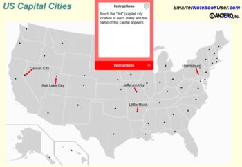
States and Capitals - Lumio (Smart Lab) or Standalone Activities
This Smart Notebook contains 12 interactive Notebook pages. (Requires Notebook 16 or higher).US Map with capital cities named. This page is provided to help students identify and locate the different states and their capitals.US Map with capital cities not named. But just touch one of the dots that represents the capital city and the name of the city appears!State Capital "Fill in the Blank" Smart Lab activity. (First of two.)State Capital "Fill in the Blank" Smart Lab activity. (Second of tw
Subjects:
Grades:
3rd - 5th
Types:

Political Borders and Regions
Teaching geography/political borders? This SMART Notebook presentation is a great addition to any geography lesson!
Grades:
4th - 8th

Features of Places (Geography Stage 1 Aus Curriculum)
Interactive cause and effect notebook program for stage 1, specifically created for Special needs students who love audio-visual stimulation in their learning activities.It features real pictures, hands on interactive games and link to online audio/video clips that enhances the sensory needs of students in their learning.
Subjects:
Grades:
K - 2nd
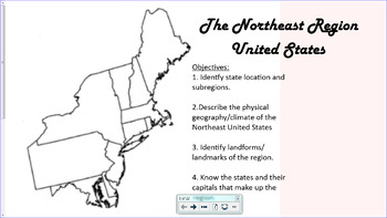
Northeast Region United States
This is an interactive smartboard lesson designed to introduce students to the Northeast Region of the United States. Made on SMARTnotebook 16.2.
Students will learn about the states in the region, their capital and abbreviation. They will also learn the subregions, New England and Middle Atlantic, the physical geography, landmarks, and climate of the region, through interactive maps, videos, and games.
Grades:
3rd - 6th
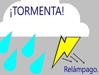
Spanish Weather (For Smartboard)
The question of the day is ¿Qué tiempo hace? Eleven fun illustrations of weather expressions in Spanish, some very basic and some fun weather slang and idioms.
Subjects:
Grades:
Not Grade Specific


Guess that Climate!
Perfect SMART Notebook interactive addition to any geography lesson.
Subjects:
Grades:
4th - 8th
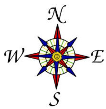
NYC Maps SmartBoard Visuals_2nd Grade
This 6-slide Notebook file is a great for introducing students to NYC maps, identifying the 5 boroughs, rivers and learning where is north, south, east and west using a compass rose.
Subjects:
Grades:
2nd
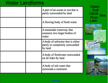
Types of Landforms Smartboard (with Pictures)
A smartboard activity for matching the landform term and picture example to (easy-to-understand) definitions. The slides are divided into "land," "water," and "mixed" landforms and include some well-known landforms such as "lake" and "island," as well as more difficult ones such as "canal" and "delta." The format allows students to use prior knowledge while exploring new terms. I paired it with this worksheet from superteacherworksheets: https://www.superteacherworksheets.com/landforms/landfo
Subjects:
Grades:
2nd - 6th
Types:

Canadian Regions Project
This is a interactive notebook designed to launch the grade 5 Social regions unit.
Subjects:
Grades:
5th
Showing 1-17 of 17 results

