44 results
8th grade geography resources for Prezi
Prezi Presentation: The British Isles and Nordic Nations
This Prezi presentation covers The British Isles and Nordic Nations! This Prezi looks at the following topics related to the geography of The British Isles and Nordic Nations: Physical Characteristics of the UKDifference between the UK, Great Britain, England, etc.Economics of the RegionHuman and Physical Geography of Wales, Ireland, Nordic Countries and ScotlandThis resource includes the link to my Prezi Lecture and Presentation! The link will allow you to access the Prezi and present it to y
Prezi Presentation: The Countries of Southwest Asia
This Prezi presentation covers The Countries of Southwest Asia! This Prezi looks at the following topics related to the Middle East: Landmarks of the Middle EastPhysical Geography of the Middle EastClimate of the Middle EastNatural Resources of the Middle EastIslam’s Basic TenetsIsrael, Syria, Lebanon, Jordan, Iraq Afghanistan, Turkey, Iran, and the Arabian PeninsulaThis resource includes the link to my Prezi Lecture and Presentation! The link will allow you to access the Prezi and present it
Prezi Presentation: European Union
This Prezi presentation covers the European Union! This Prezi looks at the following topics related to the Pros and Cons of the EU: Basics of the European UnionPros and Cons of the EUHow the EU impacts the U.S.This resource includes the link to my Prezi Lecture and Presentation! The link will allow you to access the Prezi and present it to your class!
Prezi Presentation: Mexico
This Prezi presentation covers Mexico! This Prezi looks at the following topics related to the geography of Mexico: Physical Geography of MexicoDiverse Culture of MexicoThis resource includes the link to my Prezi Lecture and Presentation! The link will allow you to access the Prezi and present it to your class!
Prezi Presentation: Introduction to the Exploration of Geography
This Prezi presentation covers the topic of the Exploration of Geography! This Prezi looks at the following topics related to the basics and introduction to Geography: The Study of GeographyThe 5 Themes of GeographyStudying the Earth’s SurfaceThis resource includes the link to my Prezi Lecture and Presentation! The link will allow you to access the Prezi and present it to your class!
Prezi Presentation: Profile of the United States
This Prezi presentation covers the Profile of the United States! This Prezi looks at the following topics related to the geography of the U.S.: Natural Resources of the U.S.Economics and Urbanization of the U.S.This resource includes the link to my Prezi Lecture and Presentation! The link will allow you to access the Prezi and present it to your class!
Prezi Presentation: The Study of Human Geography
This Prezi presentation covers The Study of Human Geography! This Prezi looks at the following topics related to the Human Geography: Population GrowthWhere People LiveThe Nature of CultureCultural ChangeThis resource includes the link to my Prezi Lecture and Presentation! The link will allow you to access the Prezi and present it to your class!
Prezi Presentation: Climates and Ecosystems
This Prezi presentation covers Climate and Ecosystems! This Prezi looks at the following topics related to weather and climate: WeatherClimateInfluences on ClimateThis resource includes the link to my Prezi Lecture and Presentation! The link will allow you to access the Prezi and present it to your class!
Southwest Asia Interactive Map Tour - Student Mapping Activity
Great mapping activity for both in-person and virtual students. The Southwest Asia Interactive Map Tour allows students to navigate a Prezi presentation as they label and color their blank map at their own pace. The activity allows for differentiation among students at different levels and is great for ESL learners. The Map Tour includes: Blank Southwest Asia Maps: Blank political maps of the region are ready to be printed and great for students to label and color. One map has a list of key
Grades:
8th - 11th
Types:
5 Themes of World Geography, Map Types and GPS PPT
Unlock the captivating world of geography with this comprehensive PowerPoint presentation designed to engage and educate students about the five fundamental themes of geography, maps, and GPS technology. Perfect for teachers looking to enhance their classroom curriculum or for homeschooling parents seeking an engaging resource, this professionally crafted presentation covers essential concepts in an interactive and visually appealing format.Key Highlights:Five Themes of Geography: Delve into the
Grades:
8th - 12th, Higher Education, Adult Education
South Asia Interactive Map Tour - Student Mapping Activity
Great mapping activity for both in-person and virtual students. The South Asia Interactive Map Tour allows students to navigate a Prezi presentation as they label and color their blank map at their own pace. The activity allows for differentiation among students at different levels and is great for ESL learners. The Map Tour includes: Blank South Asian Maps: Blank political maps of the region are ready to be printed and great for students to label and color. One map has a list of key ter
Grades:
8th - 11th
Types:
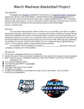
March Madness College Research Project
In this project, students are given the opportunity to simultaneously bolster their US geography knowledge, while learning about our nations great higher education institutions. Framed around the March Madness basketball tournament, students choose a participating school, conduct research, and present their findings to their classmates. A great project and a great way to bring the world into the classroom.
US Constitution & Bill of Rights: Prezi Notes Presentation
This US Constitution & Bill of Rights Prezi offers a fun alternative to PowerPoint! Use this along with the Guided Notes, and you'll have the complete package for an exciting unit on the Constitution! This Prezi is embedded with short video clips, links to resources, and stunning visuals that will have your students engaged and excited the entire time. **I have also included a PDF of the Prezi- which works much like a PowerPoint- if the Prezi file is not accepted on your device. You will
Grades:
7th - 11th
Types:
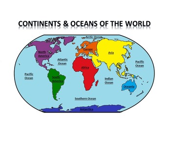
Continents & Oceans of the World Prezi
This download includes a colorful and easy to follow Prezi presentation on the 7 continents (North America, South America, Europe, Africa, Asia, Oceania and Antarctica) as well as the 5 oceans (Pacific, Atlantic, Indian, Southern and Arctic). It also includes an editable map test or worksheet with an answer key.
This Prezi includes information on size, location, population and countries of each continent along with maps and additional graphs and diagrams. Also available in PowerPoint format at
Subjects:
Grades:
6th - 10th
Types:
Africa Interactive Map Tour - Student Mapping Activity
Great mapping activity for both in-person and virtual students. The Africa Interactive Map Tour allows students to navigate a Prezi presentation as they label and color their blank map at their own pace. The activity allows for differentiation among students at different levels and is great for ESL learners. The Map Tour includes: Blank Africa Maps: Blank political maps of the region are ready to be printed and great for students to label and color. One map has a list of key terms for studen
Grades:
8th - 11th
Types:
Western Europe Interactive Map Tour - Student Mapping Activity
Great mapping activity for both in-person and virtual students. The Western Europe Interactive Map Tour allows students to navigate a Prezi presentation as they label and color their blank map at their own pace. The activity allows for differentiation among students at different levels and is great for ESL learners. The Map Tour includes: Blank Western Europe Maps: Blank political maps of the region are ready to be printed and great for students to label and color. One map has a list of k
Grades:
8th - 11th
Types:
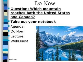
Canada Regions: Economy, Government, and Physical Features
Students will learn about Canada provinces with the background of each providence and importance.
Grades:
7th - 12th
Types:
Introduction to Maps and Map Projections PPT World Geography
Embark on an enlightening journey of discovery with our captivating PowerPoint presentation, "Unveiling Spatial Realms: Navigating Geography Through Maps, Map projections and Spatial Patterns." Carefully designed to engage learners of all ages, this comprehensive resource introduces the fascinating world of maps, spatial relationships, and their profound impact on understanding our planet.Description: More than just a collection of slides, this presentation provides an immersive educational expe
Grades:
8th - 12th, Higher Education, Adult Education
Types:
Latin America Interactive Map Tour - Student Mapping Activity
Great mapping activity for both in-person and virtual students. The Latin America Interactive Map Tour allows students to navigate a Prezi presentation as they label and color their blank map at their own pace. The activity allows for differentiation among students at different levels and is great for ESL learners. The Map Tour includes: Blank Latin America Maps: Blank political maps of the region are ready to be printed and great for students to label and color. One map has a list of key te
Grades:
8th - 11th
Types:
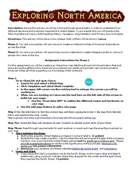
Exploring North America Interactive and Instagram Primary Source Activity--CANVA
This Project is Designed for CANVA, but could be converted to Prezi.his activity combines several historical thinking skills that are meant to help the students understand the importance and impact of the American explorations of the North American Continent during the Jefferson Era. The historical thinking skills for the first section are evidence analysis, identifying and describing causation, and argumentation.In the first section of the project, the students use secondary source material to
Grades:
6th - 10th
Types:
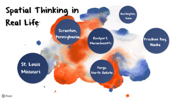
Spatial Thinking in Real Life
After your students learn about spatial thinking, use this activity using real life cities to help them figure out why cities are located in certain spots. The students can choose from 6 different cities to look at. Prezi link: https://prezi.com/view/MccgENLK1pnxYb6Pmd2q/
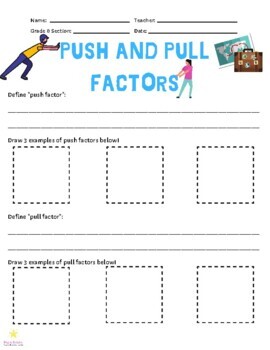
Push and Pull Factors
This set includes a link to a digital presentation that introduces immigration to Texas in the mid-1800s and helps students to identify push and pull factors.The assignment that goes with the digital presentation (3 pages) has students define push and pull factors, draw examples of each, identify whether a situation should be considered a push or pull factor and then students will write 2 examples of their own! The assignment itself could be used for other areas of study outside of Texas history
Grades:
4th - 12th
Types:
Also included in: Immigration to Texas - Mini Bundle - Texas History
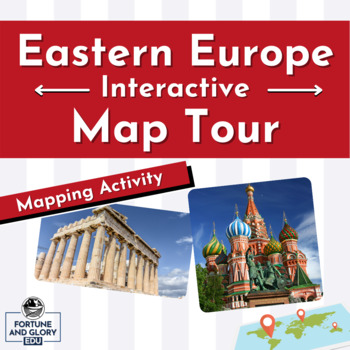
Eastern Europe Interactive Map Tour - Student Mapping Activity
Great mapping activity for both in-person and virtual students. The Eastern Europe Interactive Map Tour allows students to navigate a Prezi presentation as they label and color their blank map at their own pace. The activity allows for differentiation among students at different levels and is great for ESL learners. The Map Tour includes: Blank Eastern Europe Maps: Blank political maps of the region are ready to be printed and great for students to label and color. One map has a list of
Grades:
8th - 11th
Types:
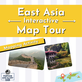
East Asia Interactive Map Tour - Student Mapping Activity
Great mapping activity for both in-person and virtual students. The East Asia Interactive Map Tour allows students to navigate a Prezi presentation as they label and color their blank map at their own pace. The activity allows for differentiation among students at different levels and is great for ESL learners. The Map Tour includes: Blank East Asia Maps: Blank political maps of the region are ready to be printed and great for students to label and color. One map has a list of key terms
Grades:
8th - 11th
Types:
Showing 1-24 of 44 results


