
Political and Physical Map of Canada for Students to Label and Colour (10 Maps)


Teacher Resource Cabin
10.7k Followers
Grade Levels
Not Grade Specific
Resource Type
Formats Included
- Zip
Pages
10 pages
Teacher Resource Cabin
10.7k Followers
What educators are saying
These were fantastic. They align perfectly with the slides and students found them clear to complete.
Great activity to use when it comes to testing my students' their knowledge on the physical regions of Canada, the capital cities and provinces, and physical features.
Also included in
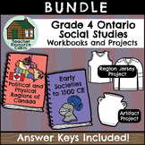 This BUNDLE contains TWO independent Social Studies workbooks and TWO design projects for Grade 4 students, as well as Maps of Canada to Colour and Label. Each workbook meets the Ontario Curriculum expectations for an ENTIRE Grade 4 Social Studies unit. Both Grade 4 Social Studies units are includedPrice $33.98Original Price $37.75Save $3.77
 This BUNDLE contains FOUR independent Social Studies workbooks for Grade 3/4 students and FOUR Social Studies projects/activities. Each workbook meets the Ontario Curriculum expectations for an ENTIRE Social Studies unit. The Grade 3 projects and workbooks are updated for the new 2023 Ontario SociaPrice $63.67Original Price $70.75Save $7.08
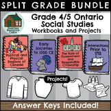 This BUNDLE contains FOUR independent Social Studies workbooks for Grade 4/5 students and FOUR Social Studies projects/activities.Each workbook meets the Ontario Curriculum expectations for an ENTIRE Social Studies unit. All Grade 4/5 Social Studies units are included.Grade 4: Political and PhysicalPrice $59.17Original Price $65.75Save $6.58
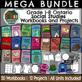 This MEGA BUNDLE contains workbooks for ALL Grade 1-8 Ontario Science Units and projects for Grade 1-6. Each workbook meets the Ontario Curriculum expectations for an ENTIRE Social Studies unit.This product is PERFECT for a prep coverage teacher who teaches Social Studies to multiple grade levels. APrice $210.60Original Price $263.25Save $52.65
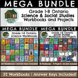 This MEGA BUNDLE contains workbooks for ALL Grade 1-8 Ontario Science and Social Studies Units. Each workbook meets the Ontario Curriculum expectations for an ENTIRE Science or Social Studies unit.This product is PERFECT for a prep coverage teacher that teaches science and social studies to multiplePrice $464.40Original Price $580.50Save $116.10
 This MEGA BUNDLE contains workbooks for ALL Grade 1-8 Ontario Science, Social Studies, and Health Units. Each workbook meets the Ontario Curriculum expectations for an ENTIRE Science, Social Studies, and Health unit.This product is PERFECT for a prep coverage teacher who teaches Science, Social StudPrice $688.80Original Price $861.00Save $172.20
Description
This resource contains 10 worksheets of maps of Canada to support students as they learn to identify and locate all of the provinces, territories, physical regions, and capitals of Canada.
This resource is made for 8.5"x11" paper, but could be resized using printer settings to accommodate larger paper. This product contains an ANSWER KEY.
Map Worksheets Included:
- Political map of Canada (Provinces/Territories) with no title and blank legend template.
- Political map of Canada (Provinces/Territories) with title, legend with province and territory names.
- Political map of Canada (Provinces/Territories) with no lines. Students will draw the boundaries of the provinces and territories of Canada
- Physical regions map of Canada with no title and blank legend template.
- Physical regions map of Canada with title, legend with with physical regions (the Cordillera, the Appalachians, the Great Lakes-St. Lawrence Lowlands, Hudson Bay Lowlands, the Canadian Shield, the Arctic, and the Interior Plains)
- Physical regions map of Canada with no lines. Students will draw the boundaries of the physical regions of Canada
- Capitals of Canada with legend. Students will locate each of the capital cities of Canada and indicate where they are using a dot and the initials of the province/territory, as shown in the legend.
- Capitals of Canada with blank labels pointing to location of capitals in the provinces and territories.
- Symbols of Canada. Students will each province and territory with drawings that represent that place. For example, an Inukshuk for Nunavut.
- Blank Map of Canada. No lines, no legend, no title, no compass rose.
⭐ French Version: FRENCH Cartes du Canada | Maps of Canada to Label and Colour (10 Maps)
Please see our Terms of Use, which are included in the product and available on our TPT store.
If you have purchased this product, please leave feedback. We are always looking for ways to improve our store and your input is important!
Total Pages
10 pages
Answer Key
Included
Teaching Duration
Lifelong tool
Report this resource to TPT
Reported resources will be reviewed by our team. Report this resource to let us know if this resource violates TPT’s content guidelines.
Reviews
Questions & Answers
10.7k Followers
