1,221 results
5th grade geography resources on sale
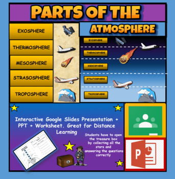
Layers Of The Atmosphere: Interactive Google Slides + PPT Version + Worksheet
Layers Of The Atmosphere: Interactive Google Slides + PPT + Worksheet (Distance Learning)Interactive presentation & quiz on Layers of the atmosphere. Please view the powerpoint previewINTERACTIVE GOOGLE SLIDES/POWER POINT PRESENTATION on layers of the atmosphere. It can be used for distance learning and google classroom or within the classroom.Once downloaded: Please view the GOOGLE SLIDES/POWERPOINT IN 'PRESENT ▶️' modeWorksheet also included in ZIP file 'Parts of the atmosphere' .These are
Subjects:
Grades:
3rd - 8th
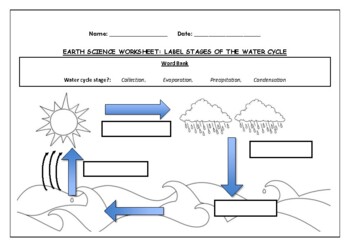
Earth Science worksheet: Label stages of the water cycle
Earth Science worksheet: Label stages of the water cycle2 VERSIONS OF WORKSHEET (Worksheet with a word bank & Worksheet with no word bank)Students have to label the stages of water cycle by looking at the diagram (Evaporation, Collection, Precipitation and Condensation)Students can color in the pictures they are doneWorksheet aimed at higher kindergarten/lower primary levelAnswer Key includedBoth PDF and Editable Word Versions included within the ZIP file
Subjects:
Grades:
K - 6th
Types:
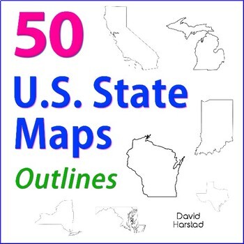
GEOGRAPHY | 50 U.S. State Maps Outlines (K-12)
GEOGRAPHY | 50 U.S. State Maps Outlines (K-12). Map outlines for all American occasions: history, physical, political, or specialty. Ideal for reports, labeling, or patriotic projects. Unfortunately, maps will not create a scaled puzzle. Preview same as Download.About the collection:Files are 8.5" x 11" in PDF & PNG. Product purchase is for organizational services. Maps are compiled from various free online sources and clarity is not always consistent. Please view Preview to see if maps mee
Grades:
K - 12th
Types:
Also included in: Top 20 Best Sellers
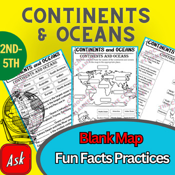
Continents And Oceans | Maps & Globes 7 Continets & Oceans | Facts Activities
Learning about continents and oceans on a map is a great way to engage students and help them remember all seven continents and major oceans in geography. This resource provides tons of practice on maps to help your kids identify the continents and oceans, as well as learn fun new information about each continent and ocean.The facts about continents and oceans are designed in different interactive formats to help your kids engage and have fun while completing them.As there are many questions reg
Subjects:
Grades:
2nd - 5th
Types:
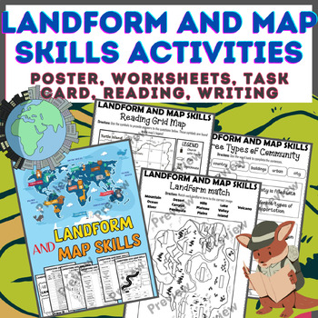
Landform & Map Skills Activity (Poster, Worksheets, Task card, Reading, Writing
Let's spice up your landform and map skills lessons and make learning super fun for your second, third, and fourth-grade students. This Landform & Map Skills Activity (Poster, Worksheets, Task card, Reading, Writing resource covers cool topics like maps, globes, continents, oceans, landforms, suburban, urban, rural areas, directions, and more!The best part? You can use these map skills and landform activities during whole group instruction, independent work, or center time. It's all about fl
Grades:
3rd - 5th
Types:
GEOGRAPHY | USA & World Maps | 135 Map Labeling Tasks (Gr. 3-7)
Geography Maps | USA & World Maps | 135 Map Labeling Tasks (Gr. 3-7). With more labeling than a box of fancy fireworks, these map worksheets bring the world to your classroom. Use map labeling for morning work, homework, or unit transitions. Students learn basic spatial locations of American states, countries, regions, and cities. Worksheets work nicely with atlas or internet maps.This listing is part of the larger Geography Bundle: Maps, Questions, Labeling. About the collection:Maps were
Grades:
3rd - 8th
Types:
Also included in: ELA Bundle (4-6th)
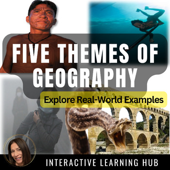
Applying the Five Themes of Geography to the REAL World
This is a lesson designed to bring the ‘Five Themes of Geography’ to life! Students will go beyond the mere rote memorization of these themes, but will explore and apply each of these themes to an eye opening example found in the REAL WORLD; whether it be a tribal man’s adaptive ability to hold his breath for an extended amount of time while deep sea hunting, to the ancient Roman’s impressive engineering skills in constructing the famous waterway system known as the aqueducts. The Slide Presenta
Subjects:
Grades:
5th - 9th
Types:
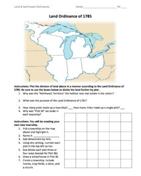
Land & Northwest Ordinances of 1785-87 / "Make Your Own Township" Simulation
This is a fantastic PDF handout to use for teaching the Land Ordinance of 1785 and the Northwest Ordinance of 1787. Students will answer fundamental questions on each act. They will then divide up the Northwest Territory into townships. They will name a township of their own, add dimensions, divide up the land into individual plots, and add homes, crop fields, churches, businesses, and a public school. On the back, students will answer more fundamental questions before creating their own "state
Grades:
5th - 12th
Types:
Also included in: 1st Semester: American Colonies to the War of 1812 Bundle
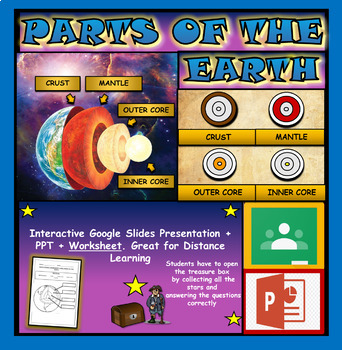
Layers and Parts of the Earth Powerpoint: Crust | Mantle | Inner and Outer Core
Layers of the Earth: Parts Of The Earth Interactive Google Slides + Powerpoint + Printable WorksheetInteractive presentation & quiz on parts of the Earth. Please view the video and PDF preview to get a better understanding of this product.INTERACTIVE GOOGLE SLIDES/POWER POINT PRESENTATION on layers of the Earth. It can be used for distance learning and google classroom or within the classroom.Once downloaded: Please view the GOOGLE SLIDES/POWERPOINT IN 'PRESENT ▶️' modeWorksheet also include
Subjects:
Grades:
3rd - 6th
Types:
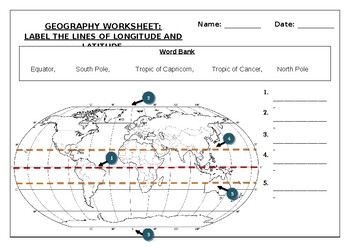
Geography worksheet: Label the lines of longitude and latitude
Geography worksheet: Label the lines of longitude and latitudeStudents have to label the lines of latitude and longitude with the correct names (Equator, South Pole, Tropic of Capricorn, Tropic of Cancer, North Pole)Worksheet aimed at primary level/ high school levelStudent can color in the world map when they are finishedAnswer key included on second page.
Subjects:
Grades:
2nd - 7th
Types:
Geography Bundle | Map Skills, Labeling, Questions for Atlas & Internet (K-12)
Geography Bundle - Map Skills - United States Geography - World Geography - Maps - Map Questions - for Atlas & Internet (K-12). Help the pilot navigate, while narrating scenic features over the intercom with your career-long geography bundle. Spatial learning abounds with basic locations of states, countries, and cities. Teach search techniques with questions and transfer information with labeling. About the collection:Maps are zipped in PDF. Resize maps or outline in Sharpie for any cl
Grades:
K - 8th
Types:
Also included in: 5th Grade Bundle
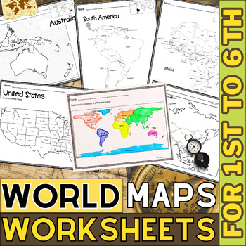
World Map with Countries | Continents and Oceans Blank Map | 1st to 12th Grade
These printable maps will be useful whether you are studying geography, world history, countries around the world, or you are just trying to show your kids the route you are taking on your next vacation! For kids learning about states, we've included a printable map of the world, as well as maps of North and South America, Europe, Asia, Australia, Africa, and Antarctica. Furthermore, the world map printable set comprises labeled and blank options for printing. To print the printable map PDF file
Grades:
K - 12th
Types:
Morning Work Bundle (4th, 5th, 6th Grade)
Morning Work Bundle (4th, 5th, 6th Grade) - 532 Worksheets & Printables. A morning work bundle for upper elementary. Use the many art illustrations as a springboard into writing prompts.• Worksheets travel nicely between grade levels. • Meets 65-82% of Common Core Writing Literacy Standards for grades 3-7. Click links for full previews. You get the following:1. Editing - 12 Printable Prompts• Labor Day• Haunted House• Winter Solstice• Sled Racing• White House Easter Egg Roll• Valentine's Day
Subjects:
Grades:
4th - 7th
Types:
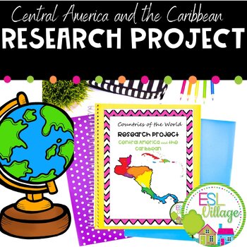
Country Research Project Central America and The Caribbean
Our engaging Country Research Project Central America and the Caribbean is perfect for a country study in the classroom. This resource includes comprehensive graphic organizers to help students structure their findings effectively. Perfect for fostering critical thinking and in-depth exploration of these vibrant regions.This project greatly facilitates differentiated instruction in the classroom by offering flexibility in assignment options. Teachers can choose to have students complete all four
Subjects:
Grades:
3rd - 9th
Also included in: Countries of the World Research Projects BUNDLE
Geography - Landforms - Continents and Oceans
Geography - Landforms - Continents and Oceans - Geography Worksheets - Power Point - Maps - Map Labeling - Flashcards - Clip Art Posters. Be the envy of world explorers everywhere and take your career-long geography bundle across many grade levels. This geography bundle includes the following: Click listings for full Previews. Geography - 100 Terms & DefinitionsGeography - Maps, Labeling, Questions:28 USA Maps35 World Maps50 U.S. State Map Outlines100 USA Geography Questions100 World Ge
Subjects:
Grades:
2nd - 7th
Types:
Also included in: Top 20 Best Sellers
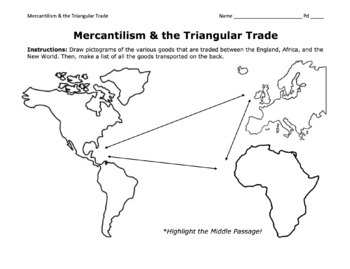
Triangular Trade & Mercantilism Map Activity / Draw Pictograms and Match Goods
This is a fantastic activity for students to learn the ins and outs of the Triangular Trade (including the Middle Passage) and mercantilism. Students will get creative and draw pictograms to represent the various goods transported over the Atlantic. On the back page, students will use a word bank to match these goods to their trade route. At the bottom, they will answer essential questions about mercantilism.©Founding Fathers USA. All rights reserved by Founding Fathers USA. This product is to b
Grades:
5th - 12th
Types:
Also included in: 1st Semester: American Colonies to the War of 1812 Bundle
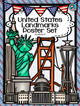
United States Landmarks Facts & Poster Set
If you are looking to improve your students skills in Geography here is the resource you need. I had so much fun researching these Landmarks and sparkle my skills also with the new facts on the most famous landmarks of the United States. Lots of information, but cool things you can use in class. Here is a set of Posters with their Fact Sheet. You can print it on card stock with double sided with the facts or separated to create your own activities for your students. The will have fun with ge
Grades:
PreK - 12th, Higher Education, Adult Education, Staff
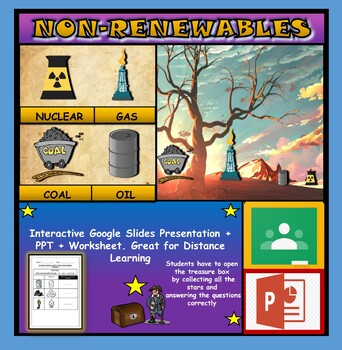
Non-Renewable Energy Sources: Interactive Google Slides + PPT + Worksheet
Non-Renewable Energy Sources: Interactive Google Slides + PPT + Worksheet (Distance Learning)Interactive presentation & quiz on non-renewable energy sources. Please view the powerpoint previewINTERACTIVE GOOGLE SLIDES/POWER POINT PRESENTATION on non-renewable energy resources. It can be used for distance learning and google classroom or within the classroom.Once downloaded: Please view the GOOGLE SLIDES/POWERPOINT IN 'PRESENT ▶️' modeWorksheet also included in ZIP file 'Non-renewable energy
Subjects:
Grades:
1st - 7th
Types:
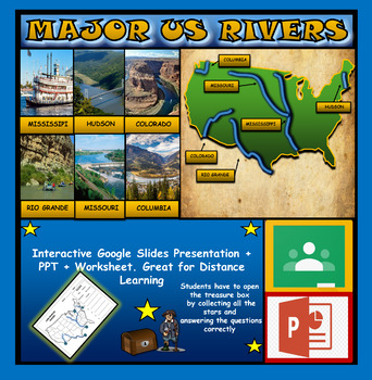
The US Major Rivers : Google Slides. Mississippi. Colorado. Hudson + Worksheets
The US Major Rivers : Google Slides, Distance Learning + Powerpoint Version + Worksheets. Interactive presentation & quiz on US major rivers. Please view the video previewINTERACTIVE GOOGLE SLIDES/POWER POINT PRESENTATION on The US major rivers. It can be used for distance learning and google classroom or on a interactive smartboard in the classroom.Once downloaded: Please view the GOOGLE SLIDES/POWERPOINT IN 'PRESENT ▶️' modeWorksheet also included in ZIP file 'Label the US rivers'. This is
Subjects:
Grades:
2nd - 7th
Also included in: U.S.A Geography Bundle: Google Slides Presentations + PPT's + Worksheets
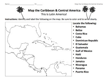
Caribbean & Central America Map / Locate the Latin American Nations
This is a simple map of the Caribbean and Central America. Students will identify the Gulf of Mexico, the Caribbean islands, and Latin American nations. Key included.©Founding Fathers USA. All rights reserved by Founding Fathers USA. This product is to be used by the original downloader only. Additional teachers must purchase their own license or TpT's multiple license option.
Subjects:
Grades:
5th - 12th
Types:
Also included in: 45+ World Maps / Map the Geographical Features of Major Countries
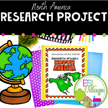
Country Research Project North America
Our engaging Country Research Project North America is perfect for a country study in the classroom. This resource includes comprehensive graphic organizers to help students structure their findings effectively. Perfect for fostering critical thinking and in-depth exploration of this vibrant region.This project greatly facilitates differentiated instruction in the classroom by offering flexibility in assignment options. Teachers can choose to have students complete all four graphic organizers or
Subjects:
Grades:
3rd - 9th
Also included in: Countries of the World Research Projects BUNDLE
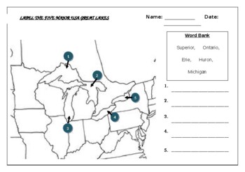
Geography worksheet: Label the five great lakes (USA)
Geography worksheet: Label the five great lakes (USA)Students have to label the major USA rivers (Ontario, Erie, Michigan, Superior, Huron)2 Versions include (B+W and a clearer Color map) Word bank/No word bank versions providedAnswer key included on the last page
Subjects:
Grades:
3rd - 8th
Types:
Also included in: Geography worksheets: USA Bundle (10 worksheets, 70%+ off)
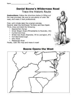
Daniel Boone's Wilderness Road Map 2.0/ Cumberland Gap, Fort Boonesborough, Etc.
I've included both a portrait-formatted AND a landscape-formatted PDF map for tracing Daniel Boone's Wilderness Road, the Appalachians, the Great Wagon Road, the Cumberland Gap, Fort Boonesborough, and other important landmarks. Please see advertised pictures of product!©Founding Fathers USA. All rights reserved by Founding Fathers USA. This product is to be used by the original downloader only. Additional teachers must purchase their own license or TpT's multiple license option.
Grades:
5th - 12th
Types:
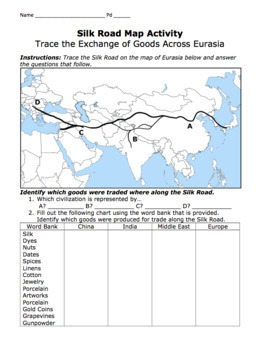
Silk Road Map Activity / Exchange of Goods Across Eurasia & Questions
Students will identify the regions along the Silk Road, as well as the goods, religions, and disease that travelled the road. They will answer important questions about the Silk Road, caravans, camels, robbers, Bubonic Plague, Marco Polo, Kublai Khan, the Yuan Dynasty, etc.©Founding Fathers USA. All rights reserved by Founding Fathers USA. This product is to be used by the original downloader only. Additional teachers must purchase their own license or TpT's multiple license option.
Grades:
5th - 12th
Types:
Showing 1-24 of 1,221 results


