1,410 results
Geography resources on sale
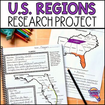
United States Geography - US Regions & State Research Project Unit
Looking for a way to make U.S. geography come alive for students? Plan a trip through the regions of the United States with this hands-on project! Students use real-world skills as they select two states in each U.S. region to visit, then research each state to decide what sites they want to see. Students then determine how they could most easily visit all of their locations in one trip and map their route. What’s IncludedPDF and Google Slide versionsExtension research page for use to different
Grades:
4th - 6th
Types:
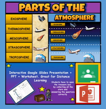
Layers Of The Atmosphere: Interactive Google Slides + PPT Version + Worksheet
Layers Of The Atmosphere: Interactive Google Slides + PPT + Worksheet (Distance Learning)Interactive presentation & quiz on Layers of the atmosphere. Please view the powerpoint previewINTERACTIVE GOOGLE SLIDES/POWER POINT PRESENTATION on layers of the atmosphere. It can be used for distance learning and google classroom or within the classroom.Once downloaded: Please view the GOOGLE SLIDES/POWERPOINT IN 'PRESENT ▶️' modeWorksheet also included in ZIP file 'Parts of the atmosphere' .These are
Subjects:
Grades:
3rd - 8th
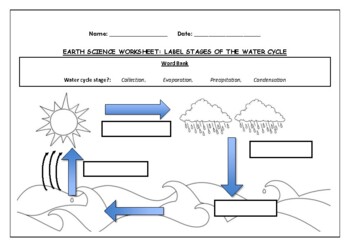
Earth Science worksheet: Label stages of the water cycle
Earth Science worksheet: Label stages of the water cycle2 VERSIONS OF WORKSHEET (Worksheet with a word bank & Worksheet with no word bank)Students have to label the stages of water cycle by looking at the diagram (Evaporation, Collection, Precipitation and Condensation)Students can color in the pictures they are doneWorksheet aimed at higher kindergarten/lower primary levelAnswer Key includedBoth PDF and Editable Word Versions included within the ZIP file
Subjects:
Grades:
K - 6th
Types:
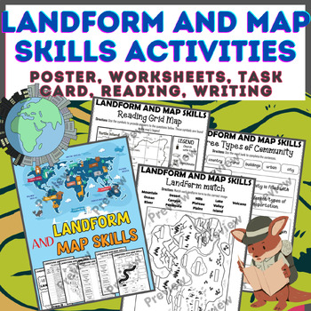
Landform & Map Skills Activity (Poster, Worksheets, Task card, Reading, Writing
Let's spice up your landform and map skills lessons and make learning super fun for your second, third, and fourth-grade students. This Landform & Map Skills Activity (Poster, Worksheets, Task card, Reading, Writing resource covers cool topics like maps, globes, continents, oceans, landforms, suburban, urban, rural areas, directions, and more!The best part? You can use these map skills and landform activities during whole group instruction, independent work, or center time. It's all about fl
Grades:
3rd - 5th
Types:
Colonial America Activity for 13 Colonies; 13 Colonies Activities
13 Colonies {New England, Middle, Southern} Scavenger Hunt Activity: A content-rich and fun way to engage students and introduce your unit! ♥You have to see the preview! OVER 600 sold and LOVED!♥This is part of my Colonies BUNDLE {3 Activities!} Let intermediate-middle grade students get up and MOVE while you introduce them to Colonial America!! In this activity, they will complete a scavenger hunt to find important information about the 13 original colonies, the New England, Middle, and Souther
Grades:
4th - 7th
Types:
Also included in: 13 Colonies Activity BUNDLE for Colonial America
Map Skills - Performance Tasks
Maps performance tasks! Here are two performance tasks that I created and used with my first grade students when we completed our unit. We actually did a practice run creating a map of our classroom early in the unit so they had experience doing something very similar to this. Updated with new BW graphics and fonts. Students get to name their own farm and playground to create the maps. They really did a great job with these and most were easily able to show Proficiency. For each map, I gave t
Subjects:
Grades:
1st - 2nd
Types:
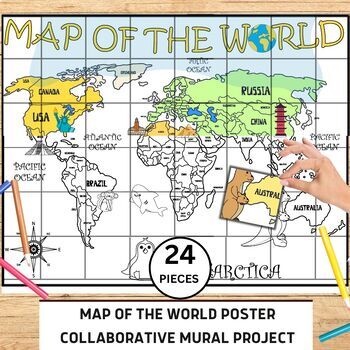
World Map Collaborative Poster Mural Project - Geography Unit , Classroom Decor
⭐️⭐️World Map Mural Collaborative Project Poster⭐️⭐️Transform your classroom with the Collaborative World Map Mural, a captivating and educational poster set. Consisting of 24 6x7 inch square pieces, students can contribute to this engaging bulletin board project. The mural promotes teamwork, critical thinking, and geographical awareness as students research and add drawings, facts, and experiences to represent different regions, countries, and landmarks. This visually stunning display fosters a
Grades:
1st - 4th
Also included in: 21 Collaboration Posters Mural Project - Classroom Decor ,Craft, BUNDLE
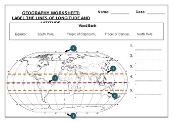
Geography worksheet: Label the lines of longitude and latitude
Geography worksheet: Label the lines of longitude and latitudeStudents have to label the lines of latitude and longitude with the correct names (Equator, South Pole, Tropic of Capricorn, Tropic of Cancer, North Pole)Worksheet aimed at primary level/ high school levelStudent can color in the world map when they are finishedAnswer key included on second page.
Subjects:
Grades:
2nd - 7th
Types:
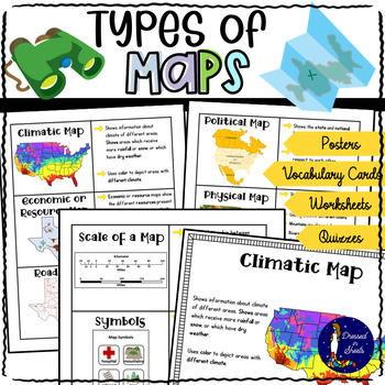
Types of Maps Worksheets with BOOM Cards | Distance Learning
This resource covers six kind of maps:Political mapsPhysical mapsTopographic mapsClimatic mapsEconomic / Resource mapsRoad mapsNot only does it explain to students what each map means but also explains what scales and map symbols are used for.There is a quiz, cut and paste activities, fill in the blanks, map symbols activity, make your own map and key project, draw that map activity, and more!There is plenty of projects to create if you let your creativity come afloat!For example poster projects
Grades:
3rd - 6th
Types:
CCSS:
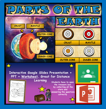
Layers and Parts of the Earth Powerpoint: Crust | Mantle | Inner and Outer Core
Layers of the Earth: Parts Of The Earth Interactive Google Slides + Powerpoint + Printable WorksheetInteractive presentation & quiz on parts of the Earth. Please view the video and PDF preview to get a better understanding of this product.INTERACTIVE GOOGLE SLIDES/POWER POINT PRESENTATION on layers of the Earth. It can be used for distance learning and google classroom or within the classroom.Once downloaded: Please view the GOOGLE SLIDES/POWERPOINT IN 'PRESENT ▶️' modeWorksheet also include
Subjects:
Grades:
3rd - 6th
Types:
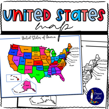
Learning and Memorizing the United States of America
Learning and Memorizing the United States of AmericaThis bundle will have everything you need to introduce the 50 states of America to students. They will be able to name each state, locate it on a map, know its abbreviation, its capital, and know what their flag looks like. This BUNDLE can also be used to make research projects regarding each individual state allowing the students to go further in knowledge regarding state flower, bird, and major industries.Check each one out and see how your s
Subjects:
Grades:
2nd - 8th
Types:
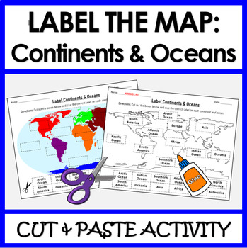
Label Continents and Oceans | Cut & Paste Sorting Activity
Let your students have fun with this cut and paste activity labelling Earth’s 7 continents and 5 oceans. This NO PREP resource provides your students with hands-on opportunity to practice labeling the continents and oceans on a world map. Three different options for a variety of practice: label the continents, label the oceans, or label BOTH the continents and oceans.Click HERE if you want a digital drag and drop version of the same activity designed for Google Slides. This product includes:Cut
Subjects:
Grades:
1st - 4th
Types:
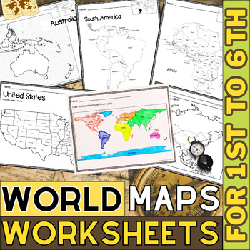
World Map with Countries | Continents and Oceans Blank Map | 1st to 12th Grade
These printable maps will be useful whether you are studying geography, world history, countries around the world, or you are just trying to show your kids the route you are taking on your next vacation! For kids learning about states, we've included a printable map of the world, as well as maps of North and South America, Europe, Asia, Australia, Africa, and Antarctica. Furthermore, the world map printable set comprises labeled and blank options for printing. To print the printable map PDF file
Grades:
K - 12th
Types:
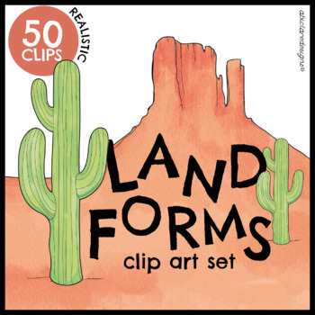
Landforms Clip Art Set
50 realistic and colorful landforms and bodies of water clips, designed for all age groups. All clips are high-quality and suited for large-scale resizing. The set is versatile, and suited for plenty of different interactive and fun classroom activities, as well as, posters, flashcards and worksheets (any printables)They can also be used for creative writing! All color clips are available to view in the preview file! You can also zoom in to have a closer look at the watercolor textures and detai
Grades:
Not Grade Specific
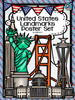
United States Landmarks Facts & Poster Set
If you are looking to improve your students skills in Geography here is the resource you need. I had so much fun researching these Landmarks and sparkle my skills also with the new facts on the most famous landmarks of the United States. Lots of information, but cool things you can use in class. Here is a set of Posters with their Fact Sheet. You can print it on card stock with double sided with the facts or separated to create your own activities for your students. The will have fun with ge
Grades:
PreK - 12th, Higher Education, Adult Education, Staff
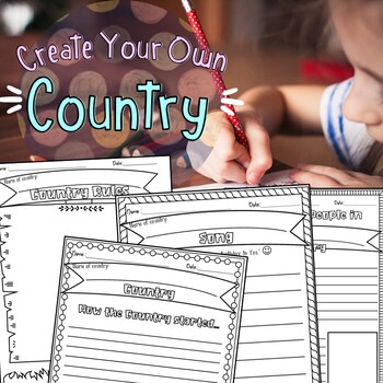
Create Your Own Country Project
Create Your Own Country Project is an exciting, fun, and creative way to get the kiddos involved in art, geography, writing, and story telling at the same time. This project can be used for young children to write, color, and imagine or for older children to be as detailed and creative as they would like. Perfect activity that can be turned into a short one day thing or an elaborate week long project which allows you to adjust. I've included a rubric which will grade the student's presentation.
Subjects:
Grades:
2nd - 3rd
Types:
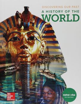
World History Bundle!!!
Included in this bundle is the entire semesters worth of curriculum over MESOPOTAMIA, ANCIENT EGYPT AND KUSH, AND ANCIENT GREECE. This material correlates with McGraw Hills' "Discovering our Past A History of the World".YOU DO NOT NEED TO USE THE BOOK TO TEACH THIS RESOURCEI have hand made all of these resources over 4 years, and condensed the chapter. This unit is ideal for Middle School/High School, and can take anywhere from a semester to two depending on the age and level of your students.Al
Grades:
5th - 10th
Types:
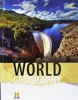
World Geography Bundle!
Included in this bundle is the entire semester/year of curriculum which correlates with HMH's "World Geography". YOU DO NOT NEED TO USE THE BOOK TO TEACH THIS RESOURCEI have hand made all of these resources over 4 years, and condensed the chapter. This unit is ideal for Middle School/High School, and can take anywhere from one semester to two depending on the age and level of your students.All of the resources will be shared through Google Drive. To keep access to this file you MUST MAKE A COPY
Grades:
4th - 10th
Types:
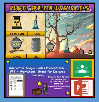
Non-Renewable Energy Sources: Interactive Google Slides + PPT + Worksheet
Non-Renewable Energy Sources: Interactive Google Slides + PPT + Worksheet (Distance Learning)Interactive presentation & quiz on non-renewable energy sources. Please view the powerpoint previewINTERACTIVE GOOGLE SLIDES/POWER POINT PRESENTATION on non-renewable energy resources. It can be used for distance learning and google classroom or within the classroom.Once downloaded: Please view the GOOGLE SLIDES/POWERPOINT IN 'PRESENT ▶️' modeWorksheet also included in ZIP file 'Non-renewable energy
Subjects:
Grades:
1st - 7th
Types:
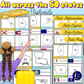
All Across the 50 States Flashcards with Capitals and Abbreviations
All Across the 50 States Flashcards with Capitals and AbbreviationsFun and informative flashcards for ALL 50 states. Each flashcard includes:Name of the stateOutline of stateState abbreviationState capitalState flagStudents will feel their practice more engaging and fun with these flashcards as they try to memorize and review state capitals, abbreviations, and flags.With the use of the index finger students can cover the name of each state capital as they quiz their peers on each state capital.A
Grades:
2nd - 11th
Types:
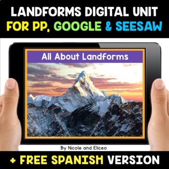
Landform Digital Activities for Google and Seesaw + FREE Spanish
Engage your students with these interactive landform activities. This digital landform unit includes 12 illustrated vocabulary terms with kid-friendly definitions, 4 informational nonfiction texts and a variety of interactive activities. It is available in PowerPoint, Google Slides and in Seesaw. It has been preloaded into Google Drive for teachers who use Google Apps or Google Classroom. It has also been preloaded into Seesaw as an interactive activity. You can use it on any device with these s
Subjects:
Grades:
K - 2nd
Also included in: Social Studies Activities for Google and Seesaw Bundle + FREE Spanish
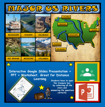
The US Major Rivers : Google Slides. Mississippi. Colorado. Hudson + Worksheets
The US Major Rivers : Google Slides, Distance Learning + Powerpoint Version + Worksheets. Interactive presentation & quiz on US major rivers. Please view the video previewINTERACTIVE GOOGLE SLIDES/POWER POINT PRESENTATION on The US major rivers. It can be used for distance learning and google classroom or on a interactive smartboard in the classroom.Once downloaded: Please view the GOOGLE SLIDES/POWERPOINT IN 'PRESENT ▶️' modeWorksheet also included in ZIP file 'Label the US rivers'. This is
Subjects:
Grades:
2nd - 7th
Also included in: U.S.A Geography Bundle: Google Slides Presentations + PPT's + Worksheets
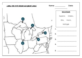
Geography worksheet: Label the five great lakes (USA)
Geography worksheet: Label the five great lakes (USA)Students have to label the major USA rivers (Ontario, Erie, Michigan, Superior, Huron)2 Versions include (B+W and a clearer Color map) Word bank/No word bank versions providedAnswer key included on the last page
Subjects:
Grades:
3rd - 8th
Types:
Also included in: Geography worksheets: USA Bundle (10 worksheets, 70%+ off)
The Dynamic Earth Full Unit Reading Worksheet Bundle *Editable*
68x Reading worksheets on The Dynamic Earth Unit of Highschool Earth and Space Science. See Thumbnails for more details. Simply purchase, download and copy!Each worksheet includes:10x questions based on the readingGreat for Sub Plans!Unlike other teacher's resources, this is totally editable!Be sure to check out these other products!General Science:Scientific Method Reading WorksheetHistory of Measurement Systems Reading WorksheetExperimental Variables Reading WorksheetEarth Science:Intro to Ear
Subjects:
Grades:
7th - 12th
Types:
Showing 1-24 of 1,410 results

