114 results
Geography handouts on sale
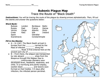
Bubonic Plague "Trace the Black Death" Map Activity 2.0 / Medieval Europe
This is a fantastic map activity to teach students characteristics of the Black Death as well as the routes along the Silk Route and sea trade routes that the Plague travelled along. Like "connect the dots," students will fill out a map, trace the plague, and answer essential questions. A key is provided.CLICK HERE for a primary source assignment on the Bubonic Plague.©Founding Fathers USA. All rights reserved by Founding Fathers USA. This product is to be used by the original downloader only. A
Subjects:
Grades:
Not Grade Specific
Types:
Applying the Five Themes of Geography to the REAL World
This is a lesson designed to bring the ‘Five Themes of Geography’ to life! Students will go beyond the mere rote memorization of these themes, but will explore and apply each of these themes to an eye opening example found in the REAL WORLD; whether it be a tribal man’s adaptive ability to hold his breath for an extended amount of time while deep sea hunting, to the ancient Roman’s impressive engineering skills in constructing the famous waterway system known as the aqueducts. The Slide Presenta
Subjects:
Grades:
5th - 9th
Types:
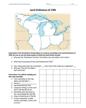
Land & Northwest Ordinances of 1785-87 / "Make Your Own Township" Simulation
This is a fantastic PDF handout to use for teaching the Land Ordinance of 1785 and the Northwest Ordinance of 1787. Students will answer fundamental questions on each act. They will then divide up the Northwest Territory into townships. They will name a township of their own, add dimensions, divide up the land into individual plots, and add homes, crop fields, churches, businesses, and a public school. On the back, students will answer more fundamental questions before creating their own "state
Grades:
5th - 12th
Types:
Also included in: 1st Semester: American Colonies to the War of 1812 Bundle
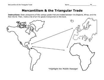
Triangular Trade & Mercantilism Map Activity / Draw Pictograms and Match Goods
This is a fantastic activity for students to learn the ins and outs of the Triangular Trade (including the Middle Passage) and mercantilism. Students will get creative and draw pictograms to represent the various goods transported over the Atlantic. On the back page, students will use a word bank to match these goods to their trade route. At the bottom, they will answer essential questions about mercantilism.©Founding Fathers USA. All rights reserved by Founding Fathers USA. This product is to b
Grades:
5th - 12th
Types:
Also included in: 1st Semester: American Colonies to the War of 1812 Bundle
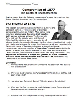
Compromise of 1877 & Military Districts Map Activity / The End of Reconstruction
This is a very resourceful activity for students to learn about the Election of 1876, Rutherford B. Hayes, Samuel J. Tilden, the Compromise of 1877, the withdrawal of military troops from the South, and the ultimate end of Reconstruction. Students will read important passages, answer essential questions, and color-code the five military districts in the South.©Founding Fathers USA. All rights reserved by Founding Fathers USA. This product is to be used by the original downloader only. Additional
Grades:
7th - 10th
Types:
Also included in: 2nd Semester: Sectionalism/Age of Jackson to Reconstruction Era Bundle
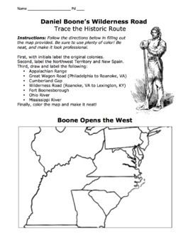
Daniel Boone's Wilderness Road Map 2.0/ Cumberland Gap, Fort Boonesborough, Etc.
I've included both a portrait-formatted AND a landscape-formatted PDF map for tracing Daniel Boone's Wilderness Road, the Appalachians, the Great Wagon Road, the Cumberland Gap, Fort Boonesborough, and other important landmarks. Please see advertised pictures of product!©Founding Fathers USA. All rights reserved by Founding Fathers USA. This product is to be used by the original downloader only. Additional teachers must purchase their own license or TpT's multiple license option.
Grades:
5th - 12th
Types:
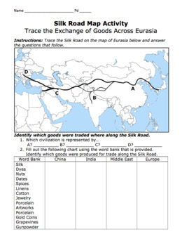
Silk Road Map Activity / Exchange of Goods Across Eurasia & Questions
Students will identify the regions along the Silk Road, as well as the goods, religions, and disease that travelled the road. They will answer important questions about the Silk Road, caravans, camels, robbers, Bubonic Plague, Marco Polo, Kublai Khan, the Yuan Dynasty, etc.©Founding Fathers USA. All rights reserved by Founding Fathers USA. This product is to be used by the original downloader only. Additional teachers must purchase their own license or TpT's multiple license option.
Grades:
5th - 12th
Types:
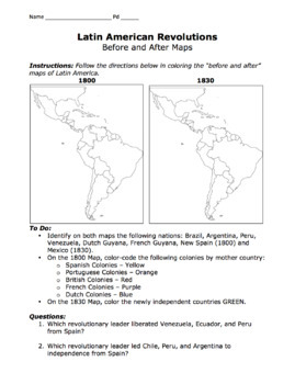
Latin American Revolutions Map / Before & After Activity / Bolivar & San Martin
This is a great map for comparing the "before and after" of the Latin American Revolutions of the 1800s. Students will compare and contrast each map as well as identify which revolutionary leader (San Martin or Bolivar) liberated which Central or South American nations.©Founding Fathers USA. All rights reserved by Founding Fathers USA. This product is to be used by the original downloader only. Additional teachers must purchase their own license or TpT's multiple license option.
Subjects:
Grades:
5th - 12th
Types:

Seeing Through Maps: Understanding Projections and Purpose
This is an introductory lesson that will have students critically explore the concepts of map projections and its' purposes. Students will come to see how there are multiple ways from which to view the Earth. Students will delve further into analyzing two maps: Mercator & Peters. Video clips are embedded within the PPT that will further help students grasp & understand important concepts. A fun & context based assessment is included which will have students analyze a variety of maps
Subjects:
Grades:
5th - 7th
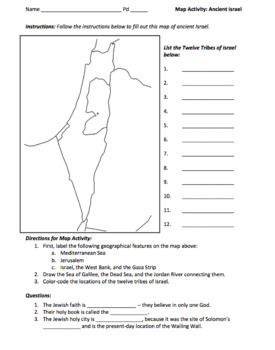
Ancient Israel Map Activity / Map the Twelve Tribes of Israel
This is a fantastic map activity for learning the geographical features of ancient Israel, including the ancestral homelands of the Twelve Tribes, i.e. Ephraim, Manasseh, Judah, Reuben, Gad, Dan, Naphtali, Asher, Issachar, Zebulon, Simeon, and Benjamin. Students will locate the Holy City of Jerusalem, the Sea of Galilee, the Dead Sea, the Jordan River, the West Bank, the Gaza Strip, etc. Finally, students will answer some basic questions on Judaism.©Founding Fathers USA. All rights reserved by F
Subjects:
Grades:
5th - 12th
Types:
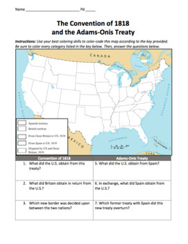
Convention of 1818 & Adams-Onis Treaty Maps / Treaties with Britain and Spain
Students will greatly benefit from this map, a visual representation of two important treaties between the U.S. and Britain (and between the U.S. and Spain). This includes the Convention of 1818 and the Adams-Onis Treaty, or the Florida Treaty. Students will follow directions by filling out this map and answering important questions below. The answer key is included.©Founding Fathers USA. All rights reserved by Founding Fathers USA. This product is to be used by the original downloader only. Add
Grades:
5th - 12th
Types:
Also included in: 1st Semester: American Colonies to the War of 1812 Bundle
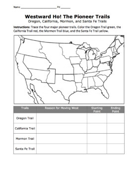
Westward Pioneers Map Activity / Oregon, Mormon, California, & Santa Fe Trails
Students will enjoy tracing the historic Oregon, Mormon, California, and Santa Fe Trails, as well as identifying their starting point, ending point, and motivations for moving westward. This is a perfect aid to help students learn the ins and outs of Westward Expansion. If you are interested in more materials on Westward Expansion, please see Unit 10: Westward Expansion below.©Founding Fathers USA. All rights reserved by Founding Fathers USA. This product is to be used by the original downloader
Grades:
5th - 12th
Types:
Also included in: 2nd Semester: Sectionalism/Age of Jackson to Reconstruction Era Bundle
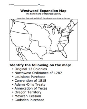
Manifest Destiny Map / Mapping Westward Expansion Activity
This is a great resource students can use to visualize the fulfillment of the Manifest Destiny of the United States. Students will color-code the maps using the list of treaties and purchases below:The Original 13 ColoniesNorthwest Ordinance of 1787Louisiana PurchaseConvention of 1818Adams-Onis TreatyTexas AnnexationOregon CountryMexican CessionGadsden Purchase©Founding Fathers USA. All rights reserved by Founding Fathers USA. This product is to be used by the original downloader only. Additiona
Grades:
5th - 12th
Types:
Also included in: 2nd Semester: Sectionalism/Age of Jackson to Reconstruction Era Bundle
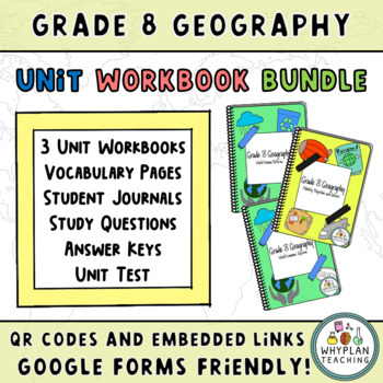
Grade 8 Geography Workbook Unit Bundle - Ontario Curriculum
This unit workbook bundle includes three Grade 8 Geography Unit Workbooks based on the Ontario curriculum. ✬This unit bundle includes:Unit 1: World Human PatternsUnit 2: World Economic SystemsUnit 3: Mobility, Migration, and Culture✬It also includes:- Vocabulary Pages - Answer Keys for every chapter- Questionnaires for each chapter (paperback and google forms)- Study Questions- Unit Test and unit projects - Embedded link and QR code page (linked to educational videos)Blog ✎ Facebook ✎ Instagram
Subjects:
Grades:
8th - 9th
Types:
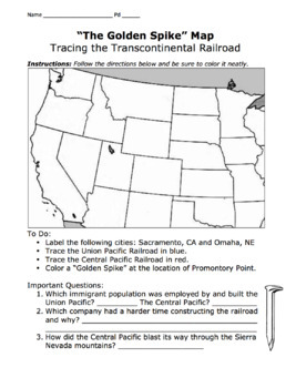
Golden Spike Map / Trace the Transcontinental Railroad, Promontory Point
This is a fantastic map that teaches students about the Transcontinental Railroad, including the Union Pacific, Central Pacific, Irish and Chinese immigrants, Promontory Point, the Golden Spike Event, etc.©Founding Fathers USA. All rights reserved by Founding Fathers USA. This product is to be used by the original downloader only. Additional teachers must purchase their own license or TpT's multiple license option.
Grades:
5th - 12th
Types:
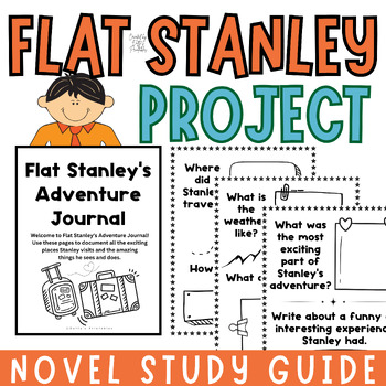
Flat Stanley Project Templates Writing Activities Novel Study
Looking for an engaging and educational Flat Stanley project for your students?This Flat Stanley set is perfect for combining creativity, writing, and geography in a fun project. Included in this pack are:Flat Stanley Outline: Students can color and customize their own Flat Stanley.Accessory Sheets: Fun items to cut and paste, making each Stanley unique.Adventure Journal Pages: Prompts and space for students to document Stanley’s travels.Postcard Templates: Templates for writing and illustrating
Subjects:
Grades:
1st - 3rd
Types:
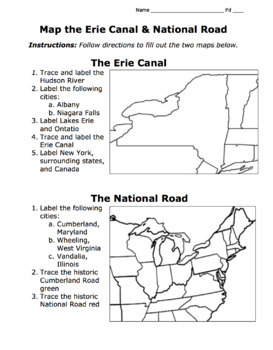
Erie Canal & National Road Map Activity / American System / Era of Good Feelings
This map will help students trace the Erie Canal and the National (Cumberland) Road of Henry Clay's American System during the Era of Good Feelings. Students will fill in the map, label important cities along the routes, etc.©Founding Fathers USA. All rights reserved by Founding Fathers USA. This product is to be used by the original downloader only. Additional teachers must purchase their own license or TpT's multiple license option.
Grades:
5th - 12th
Types:
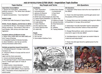
Topic Outline Sheets: World History 2 year course guide for 20 unit plans!!
Great Outline by unit and topic. There are a total of 20 Topic sheets that take you pretty much through everything for the first art of world history (first humans-Modern day).
* This is a combination package of 2 of my products with a bundle sale price *
Each individual bundle of 10 unit Outline guides is $3.99 each
Buy this combo and save $1.50!!!!
Each Topic Sheet is broken into 3/4 categories
1) Content Outline
2) Concepts and Themes
3) Vocabulary and People
4) AIM questions and essentia
Grades:
7th - 10th
Types:
My Place in Space Coloring Book (incorporates maps)
Have students explore there solar neighborhood with this mini-book.
It will help them answer the question, "Where do I really live?"
The mini-books are made by United States regions.
Southern states
Northeastern states
Midwest states
Western states
and Hawaii and Alaska
The document in all contains 2 pages (front only). Simply have the students cut and staple the 8 mini pages.
If you like this you will love my Day and Night Lesson Pack. It includes activities as well!
Visit:
http://www.
Subjects:
Grades:
K - 3rd
Types:
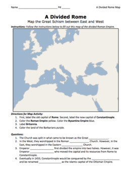
A Divided Rome Map Activity / Byzantine and Roman Empires
This map activity will enhance students' understanding of the splitting of the Roman Empire by Diocletian as well as the moving of the capital from Rome to Constantinople by Constantine. ©Founding Fathers USA. All rights reserved by Founding Fathers USA. This product is to be used by the original downloader only. Additional teachers must purchase their own license or TpT's multiple license option.
Grades:
5th - 12th
Types:

Ecological Impacts of Climate Change
The environmental impacts of climate change: shows howClimate change can change where species live, how they interact, and the timing of biological events, which can radically transform existing ecosystems and food webs. Climate change can overwhelm the ability of ecosystems to mitigate extreme events and disturbances, such as wildfires, floods and drought.
Subjects:
Grades:
7th - 12th
Grade 8 Ontario Geography Unit Workbook - World Economic Systems
✬Students will learn about The World Economy at the 8th-grade level, based on Ontario's geography curriculum. Through readings, interactive web tools, chapter questions, and mini-assignments, students will use the geographic inquiry process to analyze interrelationships among factors that can contribute to the quality of life, investigate factors that have affected the economies of developing and developed countries around the world, and assess the effectiveness of programs aimed at improving th
Subjects:
Grades:
8th
Types:
Also included in: Grade 8 Geography Workbook Unit Bundle - Ontario Curriculum
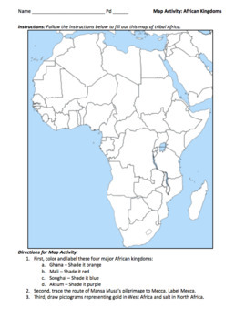
African Kingdoms Map Activity / Ghana, Mali, Songhai, & Mansa Musa's Pilgrimage
This is a fantastic map activity for learning Mansa Musa's pilgrimage and the African kingdoms of Ghana, Mali, Songhai, and Aksum. This includes the salt deposits in the north and gold in the west.©Founding Fathers USA. All rights reserved by Founding Fathers USA. This product is to be used by the original downloader only. Additional teachers must purchase their own license or TpT's multiple license option.
Grades:
5th - 12th
Types:
Also included in: 10 Middle East & North African Maps / Map the Geographical Features
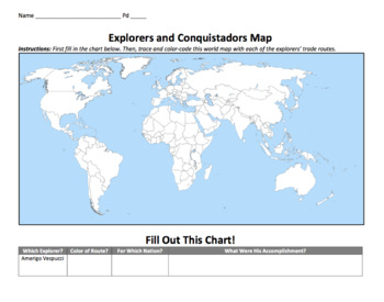
Explorers & Conquistadors Map Activity / Trace the Famous Voyages!
Students will enjoy tracing the famous voyages of Dias, De Gama, Columbus, Vespucci, Pizarro, Cortes, Coronado, De Soto, Ponce de Leon, Cabot, Cartier, and Magellan. They will use the chart to fill out the names, nationalities, route color, and significance of these explorers and conquistadors. ©Founding Fathers USA. All rights reserved by Founding Fathers USA. This product is to be used by the original downloader only. Additional teachers must purchase their own license or TpT's multiple licens
Grades:
5th - 12th
Types:
Showing 1-24 of 114 results


