716 results
Geography resources for homeschool on sale
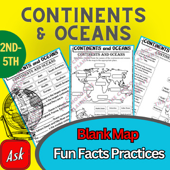
Continents And Oceans | Maps & Globes 7 Continets & Oceans | Facts Activities
Learning about continents and oceans on a map is a great way to engage students and help them remember all seven continents and major oceans in geography. This resource provides tons of practice on maps to help your kids identify the continents and oceans, as well as learn fun new information about each continent and ocean.The facts about continents and oceans are designed in different interactive formats to help your kids engage and have fun while completing them.As there are many questions reg
Subjects:
Grades:
2nd - 5th
Types:
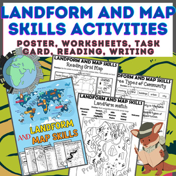
Landform & Map Skills Activity (Poster, Worksheets, Task card, Reading, Writing
Let's spice up your landform and map skills lessons and make learning super fun for your second, third, and fourth-grade students. This Landform & Map Skills Activity (Poster, Worksheets, Task card, Reading, Writing resource covers cool topics like maps, globes, continents, oceans, landforms, suburban, urban, rural areas, directions, and more!The best part? You can use these map skills and landform activities during whole group instruction, independent work, or center time. It's all about fl
Grades:
3rd - 5th
Types:
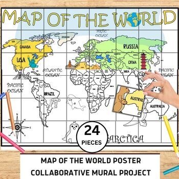
World Map Collaborative Poster Mural Project - Geography Unit , Classroom Decor
⭐️⭐️World Map Mural Collaborative Project Poster⭐️⭐️Transform your classroom with the Collaborative World Map Mural, a captivating and educational poster set. Consisting of 24 6x7 inch square pieces, students can contribute to this engaging bulletin board project. The mural promotes teamwork, critical thinking, and geographical awareness as students research and add drawings, facts, and experiences to represent different regions, countries, and landmarks. This visually stunning display fosters a
Grades:
1st - 4th
Also included in: 21 Collaboration Posters Mural Project - Classroom Decor ,Craft, BUNDLE
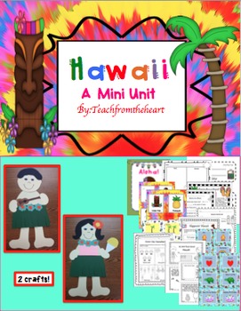
Hawaii ( A Mini Unit)
Aloha! I created this mini unit all about Hawaii for my kiddies! With so much culture and attractions, your students will feel like they just took a mini vacation! :) I have also included boarding passes to give out when you begin the unit! This is great to go with any social studies unit, too. I have also included a MINI BOOK! :)
Here's what is included:
-Hawaiian boy and girl craft (with guitar and shaved ice!) :)
-Boarding pass for girl and boy(I give these out before the unit begins)
-Aloh
Grades:
1st - 4th
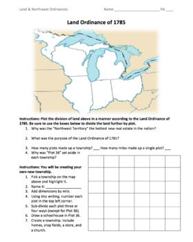
Land & Northwest Ordinances of 1785-87 / "Make Your Own Township" Simulation
This is a fantastic PDF handout to use for teaching the Land Ordinance of 1785 and the Northwest Ordinance of 1787. Students will answer fundamental questions on each act. They will then divide up the Northwest Territory into townships. They will name a township of their own, add dimensions, divide up the land into individual plots, and add homes, crop fields, churches, businesses, and a public school. On the back, students will answer more fundamental questions before creating their own "state
Grades:
5th - 12th
Types:
Also included in: 1st Semester: American Colonies to the War of 1812 Bundle
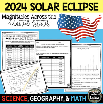
2024 SOLAR ECLIPSE MAGNITUDES ACROSS UNITED STATES - STATE CAPITALS
Are you looking for a fun activity on Solar Eclipse Day that is not busy work? This Solar Eclipse Activity integrates Science, Geography and MATH! Students handle REAL and RAW DATA about the magnitudes (for the April 8, 2024) for each state capital across the United States all while ... converting percents to fractionssimplifying fractionsordering fractionsmaking line plotsanalyzing datausing mapsreviewing state abbreviationsThis is geared towards 4th grade Math standards, but would make great p
Subjects:
Grades:
4th - 8th
Types:
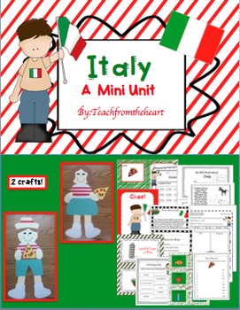
Italy (A Mini Unit)
I created this mini unit all about Italy for my kiddies! With so much culture and attractions, your students will feel like they just took a mini vacation! :) I have also included boarding passes to give out when you begin the unit! This is great to go with any social studies unit, too. I have also included a MINI BOOK! :)
Here's what is included:
-Italian boy and girl craft (with pizza) :)
-Boarding pass for girl and boy(I give these out before the unit begins)
-Ciao poster to hang up in your
Subjects:
Grades:
1st - 4th
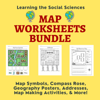
Map Skills Bundle: Symbols, Compass Rose, Globe, Maps, & More
This growing bundle (landforms still to come!!!) contains 50 worksheets, a printable book, geography posters, and a PDF book on maps! Plenty of resources to help you teach about maps!Items from the Map Worksheets Product:Map symbols cut and paste (or drag and drop)Neighborhood streets coloring & writing sheetColor items on the write streetCut and paste symbols & street namesIdentify items using street names (2 different worksheets)Draw a line to help the student get homeColor the house
Grades:
K - 1st
Types:
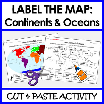
Label Continents and Oceans | Cut & Paste Sorting Activity
Let your students have fun with this cut and paste activity labelling Earth’s 7 continents and 5 oceans. This NO PREP resource provides your students with hands-on opportunity to practice labeling the continents and oceans on a world map. Three different options for a variety of practice: label the continents, label the oceans, or label BOTH the continents and oceans.Click HERE if you want a digital drag and drop version of the same activity designed for Google Slides. This product includes:Cut
Subjects:
Grades:
1st - 4th
Types:
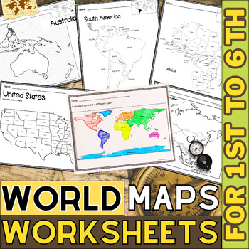
World Map with Countries | Continents and Oceans Blank Map | 1st to 12th Grade
These printable maps will be useful whether you are studying geography, world history, countries around the world, or you are just trying to show your kids the route you are taking on your next vacation! For kids learning about states, we've included a printable map of the world, as well as maps of North and South America, Europe, Asia, Australia, Africa, and Antarctica. Furthermore, the world map printable set comprises labeled and blank options for printing. To print the printable map PDF file
Grades:
K - 12th
Types:
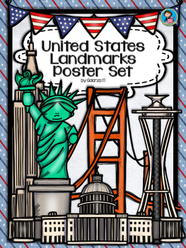
United States Landmarks Facts & Poster Set
If you are looking to improve your students skills in Geography here is the resource you need. I had so much fun researching these Landmarks and sparkle my skills also with the new facts on the most famous landmarks of the United States. Lots of information, but cool things you can use in class. Here is a set of Posters with their Fact Sheet. You can print it on card stock with double sided with the facts or separated to create your own activities for your students. The will have fun with ge
Grades:
PreK - 12th, Higher Education, Adult Education, Staff
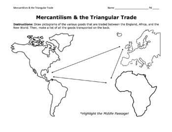
Triangular Trade & Mercantilism Map Activity / Draw Pictograms and Match Goods
This is a fantastic activity for students to learn the ins and outs of the Triangular Trade (including the Middle Passage) and mercantilism. Students will get creative and draw pictograms to represent the various goods transported over the Atlantic. On the back page, students will use a word bank to match these goods to their trade route. At the bottom, they will answer essential questions about mercantilism.©Founding Fathers USA. All rights reserved by Founding Fathers USA. This product is to b
Grades:
5th - 12th
Types:
Also included in: 1st Semester: American Colonies to the War of 1812 Bundle
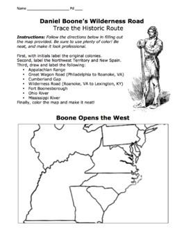
Daniel Boone's Wilderness Road Map 2.0/ Cumberland Gap, Fort Boonesborough, Etc.
I've included both a portrait-formatted AND a landscape-formatted PDF map for tracing Daniel Boone's Wilderness Road, the Appalachians, the Great Wagon Road, the Cumberland Gap, Fort Boonesborough, and other important landmarks. Please see advertised pictures of product!©Founding Fathers USA. All rights reserved by Founding Fathers USA. This product is to be used by the original downloader only. Additional teachers must purchase their own license or TpT's multiple license option.
Grades:
5th - 12th
Types:
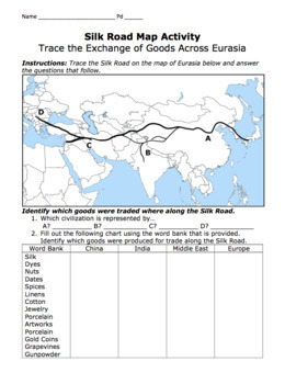
Silk Road Map Activity / Exchange of Goods Across Eurasia & Questions
Students will identify the regions along the Silk Road, as well as the goods, religions, and disease that travelled the road. They will answer important questions about the Silk Road, caravans, camels, robbers, Bubonic Plague, Marco Polo, Kublai Khan, the Yuan Dynasty, etc.©Founding Fathers USA. All rights reserved by Founding Fathers USA. This product is to be used by the original downloader only. Additional teachers must purchase their own license or TpT's multiple license option.
Grades:
5th - 12th
Types:
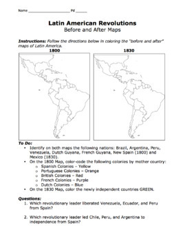
Latin American Revolutions Map / Before & After Activity / Bolivar & San Martin
This is a great map for comparing the "before and after" of the Latin American Revolutions of the 1800s. Students will compare and contrast each map as well as identify which revolutionary leader (San Martin or Bolivar) liberated which Central or South American nations.©Founding Fathers USA. All rights reserved by Founding Fathers USA. This product is to be used by the original downloader only. Additional teachers must purchase their own license or TpT's multiple license option.
Subjects:
Grades:
5th - 12th
Types:
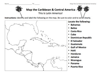
Caribbean & Central America Map / Locate the Latin American Nations
This is a simple map of the Caribbean and Central America. Students will identify the Gulf of Mexico, the Caribbean islands, and Latin American nations. Key included.©Founding Fathers USA. All rights reserved by Founding Fathers USA. This product is to be used by the original downloader only. Additional teachers must purchase their own license or TpT's multiple license option.
Subjects:
Grades:
5th - 12th
Types:
Also included in: 45+ World Maps / Map the Geographical Features of Major Countries
Let's Go--Travelling across the 50 States Social Studies Unit
This newly updated Social Studies unit will equip your students with a variety of research, critical thinking, creative thinking, and communication skills! From in-class projects to home-based learning, this social studies project-based learning experience will be a hit with students, parents, and administrators! Instructions, pictures, and printables are plentiful. Students may work collaboratively or independently, and there is much flexibility for teachers. What a great unit to promote pa
Grades:
3rd - 8th
Types:
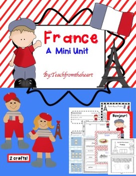
France (A Mini Unit)
I created this mini unit all about France for my kiddies! With so much culture and attractions, your students will feel like they just took a mini vacation! :) I have also included boarding passes to give out when you begin the unit! This is great to go with any social studies unit, too. I have also included a MINI BOOK! :)
Here's what is included:
-French boy and girl craft (with Eiffel Tower and flag) :)
-Bonjour poster to hang up in your room
-Food, Architecture, Holidays, Location chart
-F
Subjects:
Grades:
1st - 4th
Kids in Other Countries Lessons: Free Video Series: Distance Learning
Supporting Inclusive Resources to create Inclusive Classrooms for Elementary School ChildrenOne of my best discoveries this year, is the FREE on-line video series: Kids in Other Countries This free video series has been instrumental in developing global awareness while creating an atmosphere of appreciation within my grade two class. My goal in creating this resource was to support the video series by having students, reflect, connect, challenge and transform their thinking about social standar
Subjects:
Grades:
2nd - 6th
Types:

Continent Asia Reading Comprehension | Asian History Geography and Culture
Discover the multifaceted wonders of Asia with our comprehensive reading bundle! Delve into the rich history, diverse geography, vibrant cultures, ancient religions, myriad languages, captivating art, enchanting music, traditional dances, and mouthwatering cuisine of Asia. These engaging worksheets are designed to enhance reading comprehension and foster a deeper understanding of the complexities and beauty of the Asian continent. Download now to embark on an enlightening journey through Asia!As
Grades:
5th - 12th
Types:
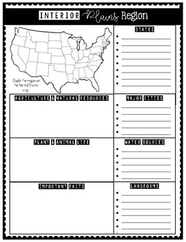
7 Natural Regions of the United States (Research Activity Posters)
These 7 Natural Regions Posters are perfect for engaging students in an interactive research activity!
Students will enjoy shading their assigned region on the U.S. map and writing research notes in the boxes.
Have students use this to write a research paper and keep facts organized.
These 7 natural regions are aligned with the USA Studies curriculum.
Natural Regions included:
1. Pacific Coastal Plains
2. Western Plateau
3. Rocky Mountains
4. Interior Plains
5. Atlantic Coastal Plains
6. A
Grades:
3rd - 5th
Types:
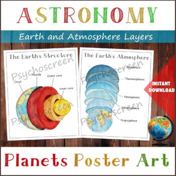
Earth Structure and The Earth's Atmosphere • Layers of the Earth • Posters
֎ ABOUT THE PRODUCT ֎Handmade watercolor print, instant download. Great material for learning about the layers of the Earth and about Atmosphere in homeschooling or in classroom. The product includes:· The Earth's Structure - poster + diagram + parts (labels)· The Earth's Atmosphere - poster + diagram + parts (labels)֎ DIGITAL DOWNLOAD ֎· PDF file in Letter size, with 5 pages. Size: Letter - 2550px x 3300px, 8.5" x 11", 21,59cm x 27,94cm. You can fit it on A4 size. Lamination extends the duratio
Subjects:
Grades:
PreK - 5th
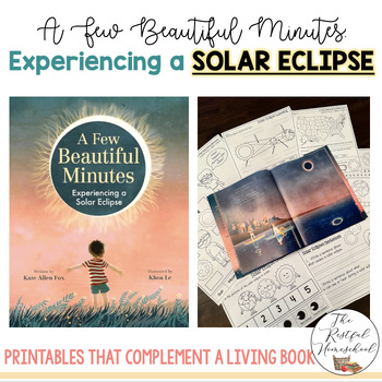
SOLAR ECLIPSE: A Few Beautiful Minutes Experiencing a Solar Eclipse - Literature
Are you looking for a fun and beautiful way to teach your students about solar eclipses? These printables perfectly complement the living book, "A Few Beautiful Minutes: Experiencing a Solar Eclipse" by Kate Allen Fox. Click the link to check out this amazing story. These printables are geared toward Pre-K to 3rd grade students, and each page includes pictures for students to color.Included:Writing (Use the story to help students share what they learned about solar eclipses!)Concept Map- What Ha
Subjects:
Grades:
PreK - 5th
Types:
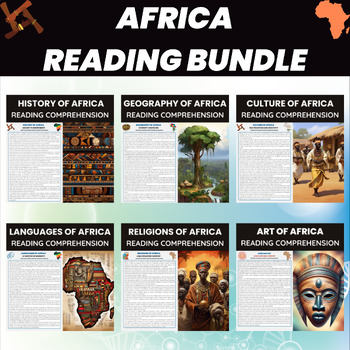
Africa Reading Comprehension Worksheets | African Continent History Geography
Explore Africa's rich history, geography, culture, languages, religions, and art with our comprehensive worksheets bundle. From ancient civilizations to vibrant traditions, these worksheets engage students with diverse aspects of the African continent. Perfect for enhancing reading comprehension and fostering a deeper understanding of Africa's multifaceted identity. Download now to dive into the world of Africa!Africa Reading BundleHistory of AfricaGeography of AfricaCulture of AfricaLanguages o
Grades:
5th - 12th
Types:
Showing 1-24 of 716 results


