6,141 results
Higher education geography resources under $5
Maps of the World: Clip Art World Maps
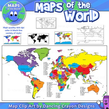
Maps of the World: Clip Art World Maps
High quality color and black and white maps of the world.
This clipart map set contains the following commercial use graphics:
- Color maps of the world
- Black and white line art maps of the world
- Maps of the world with lines of latitude and without lines of latitude
- Maps of the world with larger countries labelled (color and black and white)
- Silhouette maps of the world
- A map of the world showing seven continents in color and black and white:
Grades:
3rd - 12th, Higher Education, Adult Education, Staff
Also included in: Maps of the World Clip Art - MEGA-BUNDLE
Central and Southwest Asia (Middle East) - Mapping Activity
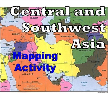
Map Activity – Central and Southwest AsiaIn this activity, students must locate and identify the countries (and capital cities if so desired) of Central and Southwest (or Middle Eastern) Asia. When students are finished with this, time can be spent coloring in the various countries.Included in this package is a ready-to-copy blackline master map of Central and Southwest Asia along with a separate answer key.This product can also easily be used as a test or quiz.Preview file is available for down
Subjects:
Grades:
4th - 12th, Higher Education, Adult Education
Types:
Also included in: Map Activity Bundle
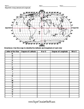
Latitude and Longitude Worksheet & Answer Key
This worksheet is an awesome way to teach Latitude and Longitude. The way that it is structured reinforces that Latitude measures North and South of the Equator, and that Longitude measures East and West of the Prime Meridian. This worksheet features a World Map with an Answer Key.
Subjects:
Grades:
3rd - 12th, Higher Education, Adult Education
Types:
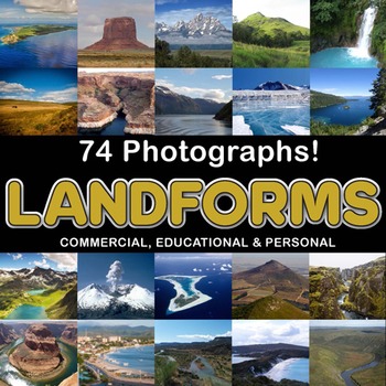
Photos Photographs LANDFORMS clip art
Photographs - Landforms. For sale are 74 beautiful, full color, high quality 300 dpi photographs for commercial, personal and educational use. No credit required to use these images, but it is always appreciated if you do! Why use clip art when you can use images of real objects? Every single image is available for you to use commercially in every one of your products. Buy with confidence! The thumbnail images are watermarked /cropped in the preview / thumbnails but the purchased photographs wil
Subjects:
Grades:
PreK - 12th, Higher Education, Adult Education
Also included in: Complete Photo Bundle
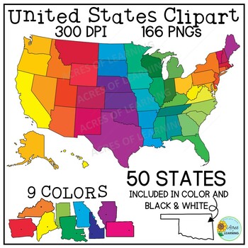
United States Map Clipart | States and Capitals | US Regions
Make creating state reports or activities that help students memorize the states and capitals easy with this set of brightly colored United States clipart! You get a total of 166 state shapes and maps of the U.S. The images can be used in so many ways! Create flashcards, map quizzes, states and capital worksheets. Use to create digital resources such as Boom Cards or Google Slide state reports. Perfect for social studies classrooms or for teaching US geography. All images come in 300 DPI PNG f
Grades:
3rd - 8th, Higher Education
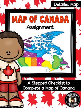
Map of Canada Assignment - Detailed Map
This is a minimal-prep assignment that you can simply photocopy and distribute to students now! The assignment is broken down into 10 steps and is perfect for an applied or academic classroom. The assignment includes a built-in checklist for students to use while completing their maps.
There are two versions of this assignment included in this download – one with and one without the post-it note annotation. There are also two rubrics to reflect both versions of this assignment. You can use the
Subjects:
Grades:
4th - 12th, Higher Education, Adult Education
Types:
Create Your Own Country Project-Step by Step Guide-Editable
In this project, students will be working in pairs to create their own country from scratch. They will also choose a type of government for their country. Their final product will be a brochure and a PowerPoint presentation.This resource includes:PowerPoint presentation with complete project detailsStudent Handout following the Power Point Presentation (PDF and MSWORD)Rubric for grading the brochure and presentation (PDF and MSWORD)PowerPoint Presentation Images are flattened but all titles and
Subjects:
Grades:
4th - 12th, Higher Education
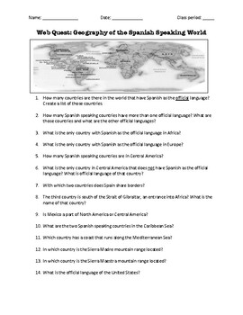
Web Quest: Geography of the Spanish-Speaking World (emergency sub plan)
This activity contains 40 questions in English written in a trivia format. It is excellent if you plan to have a substitute teacher as it will keep your students busy researching answers. The questions can also be useful to motivate class discussion. Includes answer key.
Subjects:
Grades:
5th - 12th, Higher Education, Adult Education
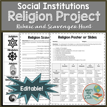
Religions of the World Project
Have your sociology, history, or geography students learn about religions of the world without sitting through a lecture. Each student or group will research a specific religion and create a poster to display around the classroom, or slides to post digitally. Students will then engage in a scavenger hunt, competing to answer questions based on the posters or slides that students create.
You Get:
-An editable rubric and check list
-Cards from which to select a religion to research (also editabl
Subjects:
Grades:
10th - 12th, Higher Education
Types:
The Consequences of Global Climate Change / Global Warming - PowerPoint
A comprehensive, colorful, and engaging 48-slide PowerPoint presentation exploring the various environmental and socio-economic consequences and effects of global climate change. Clear, objective with easy-to-follow text, explanations, photos, and videos.Climate change topics include: rising sea levels, loss of biodiversity, famine, desertification, and even a colder Europe.Students also learn, however, that there may arguably be a few potential benefits associated with global warming such as in
Subjects:
Grades:
7th - 12th, Higher Education
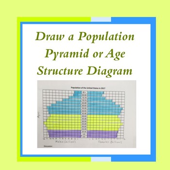
Age Structure Diagram for Biology, APES and Geography-Distance Learning
This quick and easy activity helps students make their own population pyramid (also called an age-structure diagram) using data provided. Creating a pyramid allows students to more easily interpret pyramids/diagrams on exams or assessments. An answer key is included.
Subjects:
Grades:
9th - 12th, Higher Education
Types:
Also included in: AP Environmental Science Unit 3 Bundle
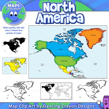
North America Continent Maps: Clip Art Map Set
North America Continent Maps: Clip Art Map Set
Map Collection: North American Continent
A set of clip art maps of North America. Note: These maps show the entire region of North America and do not contain individual country maps.
This clipart map set contains the following commercial use graphics:
- Color maps of North America
- Labelled maps and blank maps
- Black and white line art maps of North America
- Silhouette of the North American continent
- Map of the world hig
Grades:
PreK - 12th, Higher Education, Adult Education, Staff
Also included in: Maps of the World Clip Art - MEGA-BUNDLE
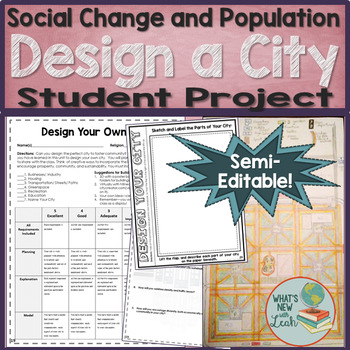
Design Your Own City Project
Have your sociology students design their own cities during a unit on social change and population. The purpose of this activity is to design a city that fosters community, interaction, and sustainability.
Models can be built tangibly, with blocks, poster board, file folders, etc., or virtually, with Minecraft (if your school has a Minecraft education subscription), City Creator (free, web-based), or let the students devise their own method. Some may choose to simply draw a detailed diagram on
Grades:
10th - 12th, Higher Education
Types:
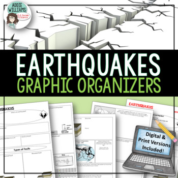
Earthquakes / Faulting Graphic Organizer | Print & Digital
Earthquakes / Faulting Graphic Organizer - A great way for students to organize information on earthquakes and faulting. Instead of asking students to take traditional notes, they fill in the graphic organizer - either as review or instead of standard question and answer in a textbook. Excellent for review or group work. Includes 4 pages of organizers and all answer keys!Also includes a link to a Google™ Slides version of the organizers so students can add text, images, color and more while wo
Subjects:
Grades:
8th - 10th, Higher Education, Adult Education
Also included in: Plate Tectonics / Earthquakes / Volcanoes Organizers | PRINT & DIGITAL
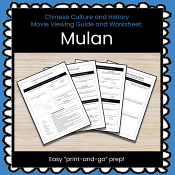
Mulan (2020) Movie Viewing Guide & Worksheet (Chinese Culture and Geography)
Add another interesting element to your Geography of China Unit with this "Mulan (2020)" Movie Viewing Guide and Worksheet.This lesson includes a pre-screening activity with basic questions about Geography and cultural concepts that might require students to conduct a little bit of research.The viewing guide is split into four sections to go along with the movie. Each of the four sections contains questions that are designed to make students think about the people and ideas at play in the film a
Subjects:
Grades:
9th - 12th, Higher Education
Also included in: ★ GROWING BUNDLE ★ All Social Studies Lessons (30% Discount)
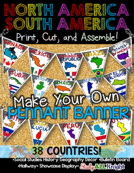
North America South America Classroom Decor Make Your Own Pennant Banner
North America South America Classroom Decor Make Your Own Pennant Banner
Grades K-12 social studies, history, geography, Model UN, global studies, world history
Celebrate our world! Teachers can decorate their classrooms, hallway, gymnasium, media center, or anywhere in their building. You'll get 38 pennants to choose from. Pick pennants that represent your student's heritage, ethnicities, backgrounds, ancestry.
They are colorful and awesome to look at. The countries pennant will bring enthu
Grades:
PreK - 12th, Higher Education, Adult Education, Staff
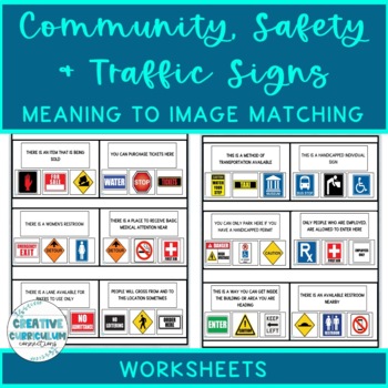
Community, Safety & Traffic Signs Sign Definition to Image Matching Worksheets
For this community instruction based lesson, students are presented with varying community, traffic, or safety signs visually/in word form. Students will work on their functional vocabulary skills by identifying the sign's name and image. Students are asked to review the provided sign meaning or definition and match it to its image, out of an array of three. Students will work on identifying sign based vocabulary words, reading signs, defining signs/understandings purpose and more!There are 15 w
Subjects:
Grades:
1st - 12th, Higher Education, Adult Education
Types:

Human Population Virtual Lab with updated links
For AP Environmental Science, AP Human Geography and Biology classes.Students use two ESRI websites with interactive maps to discover trends in population size, population density, infant mortality, life expectancy, age structure diagrams (population pyramids), doubling time and population growth.Many answers are open-ended which prevents copying of work as student choose countries in the world as examples from the data.4 pages for student worksheets. 5 pages for answer key.
Subjects:
Grades:
9th - 12th, Higher Education
Types:
Also included in: AP Environmental Science Unit 3 Bundle
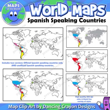
Spanish Speaking Countries | Maps of the World Clip Art
Maps of the World: Clip Art of Spanish Speaking Countries on World MapHigh quality color and black and white maps of the world with Spanish speaking countries labeled and highlighted. This clipart map set contains the following commercial use graphics:- Color maps of the world labeled with only Spanish speaking countries- Black and white line art maps of above- labeled and blank maps of above*Includes TWO versions. One showing only countries which have Spanish as an official language, and two,
Grades:
3rd - 12th, Higher Education, Adult Education, Staff
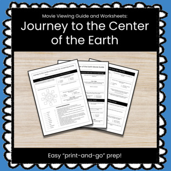
Journey to the Center of the Earth Movie Viewing Guide & Worksheet
Add another interesting element to your Basics of Earth Science or Geography Units with this "Journey to the Center of the Earth" Movie Viewing Guide and Worksheet.This lesson includes a pre-screening activity with basic questions about Geography and Earth Science concepts that might require students to conduct a little bit of research.The viewing guide is split into four sections to go along with the movie. Each of the four sections contains questions that are designed to make students think ab
Subjects:
Grades:
9th - 12th, Higher Education
Also included in: ★ GROWING BUNDLE ★ All Social Studies Lessons (30% Discount)
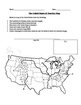
Geography: United States Map Exercise
This activity is a map of the United States containing some landforms and physical features as well as political state lines. Students are asked to label landforms like mountain ranges, rivers, lakes, and bodies of water as well as the state names. Students are also asked to create a map title and a legend to show what colors they used to color in bodies of water and mountain ranges.
Subjects:
Grades:
3rd - 12th, Higher Education
Types:
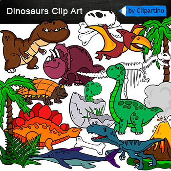
Dinosaurs Clip Art Commercial use
Cute Dinosaur Clip Art Commercial use/ Dino Clipart includes: fern * dino egg* volcano* Bones with skull Dinosaur* bone *dinosaur skeleton* ankylosaurus* apatosaurus* ichthyosaurus* pterodactyl* stegosaurus* triceratops* tyrannosaur* tyrannosaurus rex *tyrannosaurus rex.Download preview with free clipart inside license included!All18 png files transparent background+jpgand 17 png black-white coloring outlines files+jpgFor personal and small commercial use!!!! See more animals clipartDinosaurs of
Grades:
PreK - 12th, Higher Education, Adult Education, Staff

Demographic Transition Model Game
27 slide "game show". This is my grand attempt to make the Demographic Transition Model fun and applicable to life situations. And it worked! This game presents pictures and gives short scenarios (ex: "Mr. Doug loses his job as a grave digger"). Students then guess the demographic stage. (Answer: STAGE 3 because death rates are dropping fast, so less graves need to be dug than before.)
Includes directions and the ANSWERS and the end.
My students complained, "It made me have to think!" Always a
Grades:
8th - 12th, Higher Education
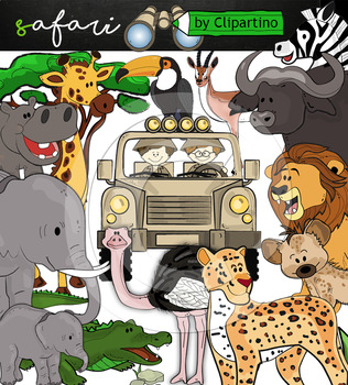
Cute Safari animals Clip Art /African Animals /Commercial use
Safari clipart bundle inclides 22 png files transparent background+jpgand safari clip art 22 png+jpg black-white filessize 1 files about 6 inch 300 dpiFor personal and commercial use!!!African Animals & Savanna clipart (Animal jungle clip art)BinocularjeepJeep with boysBoyscrocodileantelopehippoelephantbaby elephantbuffaloa lionleopardhyenarhinoceroshippostonebeaktreegrassostrich!!!! See more animals clipartOcean animals clipartSafari clipartBugs clipartBirds ClipartDinosaur ClipartArctic An
Grades:
PreK - 12th, Higher Education, Adult Education, Staff
Showing 1-24 of 6,141 results


