79 results
7th grade geography resources for SMART Notebook
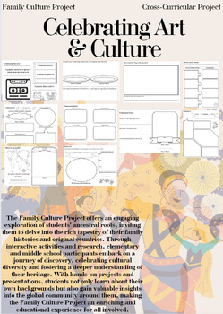
Family Culture Project: Activities, Resources, Google Slides and Lessons
The Family Culture Project offers an engaging exploration of students' ancestral roots, inviting them to delve into the rich tapestry of their family histories and original countries. Through interactive activities and research, elementary and middle school participants embark on a journey of discovery, celebrating cultural diversity and fostering a deeper understanding of their heritage. With hands-on projects and presentations, students not only learn about their own backgrounds but also gain
Subjects:
Grades:
1st - 8th
Types:
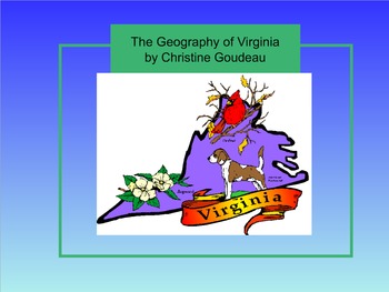
Virginia Studies SMARTboard Lesson - VA Geography - VS.2
**Updated to the NEW Virginia SOLS (2016)**
This is a 26 page instructional SMART Board lesson that covers Virginia Studies SOLs VS.2 a,b,c - the entire Virginia Geography Unit. This lesson is full of interactive activities, video clips, websites, pictures and more!
This SMARTboard usually takes me about 2 -3 weeks to teach. It is aligned perfectly to my interactive notebook on this topic that is also listed here on TPT. You can find it here: https://www.teacherspayteachers.com/Product/Virgin
Grades:
3rd - 8th
Types:
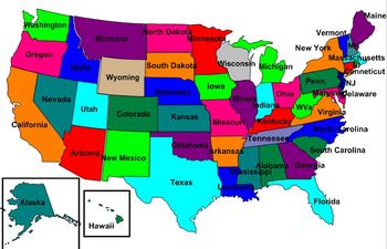
United States Labeling Puzzle Map
This is a map of the United States for students to label. Teachers can scramble up the puzzle and students put it back together. This is a great activity to get students up out of their seats and do a hands-on activity with technology
Subjects:
Grades:
6th - 10th
Virginia Studies SMARTboard Lesson - Virginia Government & Economy - SOL VS.10
This 16 page instructional SMARTboard unit lesson covers the topic of "Virginia Government and Geography." This lesson covers ALL of the Virginia SOLs VS.10 (updated with NEW SOLs in 2017). This lesson is fun, well organized, and will keep your students' attention! It has tons of pictures, video clips, and interactive parts. Use my SMARTboards in place of a textbook! My interactive notebooks (also featured on TPT) correspond perfectly with the SMARTboards and are a perfect way for your stud
Grades:
3rd - 9th
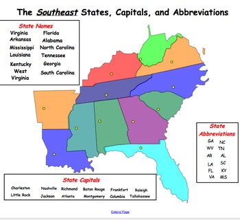
Southeast Region Map and Smartboard Activities
This Smartboard document contains slides of the Southeast region and includes labels for state names, capitals and abbreviations that can be dragged and dropped on the map. In addition, there is a slide which includes key words which can be dragged and dropped into the graphic organizer under the topics of geography, climate, agriculture, manufactoring, history and culture. This is a great activity for a social studies center or whole group instruction.
Subjects:
Grades:
2nd - 8th
Also included in: REGIONS OF UNITED STATES SMART BOARD SLIDES *BUNDLE/ EDITABLE
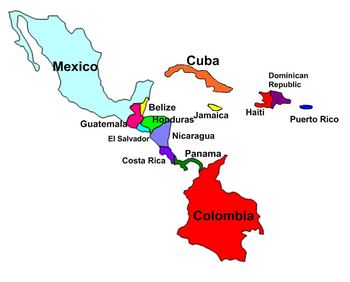
Central America and Caribbean Labeling Puzzle map
Map of Central America and Caribbean for students to label. Teachers can scramble up the puzzle and students put it back together. This is a great activity to get students up out of their seats and do a hands-on activity with technology
Subjects:
Grades:
6th - 10th

Geography- Europe Labeling Puzzle Map
Map of Europe for students to label. Teachers can scramble up the puzzle and students put it back together. This is a great activity to get students up out of their seats and do a hands-on activity with technology
Subjects:
Grades:
6th - 10th
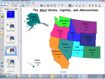
West Region Map & Smartboard Activities
This Smartboard document contains slies of the west region and includes labels for state names, capitals and abbreviations that can be dragged and dropped on the map. In addition, there is a slide which includes key words which can be dragged and dropped into the graphic organizer under the topics of geography, climate, agriculture, manufactoring, history and culture. This is a great activity for a social studies center or whole group instruction.
Subjects:
Grades:
2nd - 8th
Also included in: REGIONS OF UNITED STATES SMART BOARD SLIDES *BUNDLE/ EDITABLE
Virginia Geography & Regions Review SMARTboard Game
This is a SMARTboard Jeopardy style game to review the Viriginia 4th Grade Social Studies SOLs for Virginia Geography & Regions. Categories include: Virginia Regions, Virginia Waterways, Products, Industries, & Miscellaneous. This is a great way to end your study of this unit or to review for SOLs! It can be used after my Virginia Geography instructional SMARTboard lesson, also listed on Teachers Pay Teachers!
Grades:
3rd - 8th
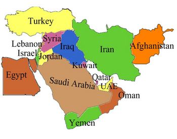
Middle East Labeling Puzzle map
Map of the Middle East for students to label. Teachers can scramble up the puzzle and students put it back together. This is a great activity to get students up out of their seats and do a hands-on activity with technology
Subjects:
Grades:
6th - 10th
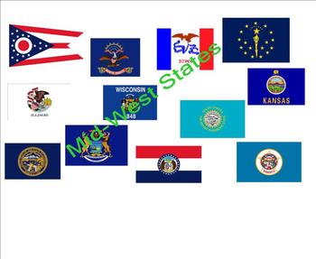
States and Capitals - Mid-West States
An interactive activity that provides your students a fun way to practice states, capitals, and abbreviations for the Mid-Western states. Great for social studies, center time, or mini-lessons. The Browns.
Grades:
2nd - 12th

5 Themes of Geography Smartboard Lesson
This is a Smartboard activity that uses an interactive whiteboard to help the students become engaged in the lesson. The lesson focuses on the 5 themes of geography: location, place, movement, region, and human-environment interaction. This activity provides definitions, as well as examples of the themes of geography. Students are able to interact with the information throughout the entire lesson.
Subjects:
Grades:
4th - 9th
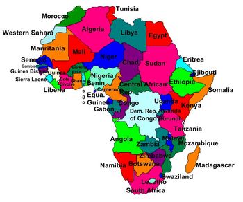
Geography- Africa Labeling Puzzle map
Map of Africa for students to label.
Teachers can scramble up the puzzle and students put it back together. This is a great activity to get students up out of their seats and do a hands-on activity with technology
Subjects:
Grades:
6th - 10th
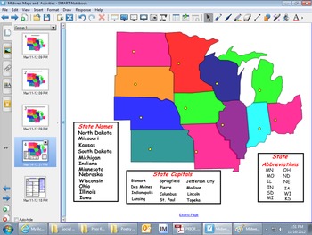
Midwest Regions Map and Smartboard Activities
This smarboard file is the map of the Midwest and can be used to teach students the state names, capitals and abbreviations of the states of the Midwest. Students can interact with the map as they drag the labels to the correct places. In addition, there is a slide where students can drag key words in the areas of the geography, climate, agriculture, manufactoring, history and culture of the Midwest region.
Subjects:
Grades:
2nd - 8th
Types:
Also included in: REGIONS OF UNITED STATES SMART BOARD SLIDES *BUNDLE/ EDITABLE

Physical Features/Landforms Smartboard Lesson
This Smartboard acitivity teaches students about the different landforms around the world. Students learn the definitions, as well as examples of many landforms. They are able to interact with the lesson on an interactive whiteboard, completing activities such as matching pictures with definitions. It is a great lesson that can be used as an introduction to the topic, review, or assessment.
Grades:
3rd - 9th

Geography Skills
This is an interactive whiteboard lesson that covers the basics of geography. Terms covered include: Hemispheres, lines of latitude and longitude, parts of a map, types of maps and map projections. Great for social studies or geography class!
Subjects:
Grades:
2nd - 12th
Types:
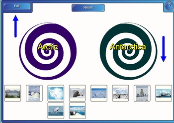
Polar Regions - Antarctica and the Arctic
This SMART notebook files forms 5 complete lessons about Polar Regions:
1. Intro and the difference between Antarctica and the Arctic,
2. Antarctica,
3. The Arctic,
4. Animals of the Polar regions
5. Human Impact on the Polar Regions.
This can be used every day over a week, which would be great for a relief teacher, or as a unit plan over 5 weeks for a class teacher.
The lessons include pictures, videos, interactive parts and each lesson has an activity to complete at the end to summarise
Subjects:
Grades:
3rd - 9th
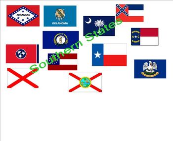
States and Capitals - Southern States
An interactive activity that provides your students a fun way to practice states, capitals, and abbreviations for the Southern states. Great for social studies, center time or mini-lessons. The Browns.
Grades:
2nd - 12th
Unit 1 World History - Jeopardy Game (Places) SmartBoard Game
SmartBoard Jeopardy game that covers beginning 6th grade world history. Includes questions about map skills, geography, basic religions, and important skill-building facts.
Support activity to review for test from the Unit 1 PowerPoint.
Grades:
5th - 8th
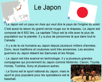
Pays du Jour
French Smart Notebook project with the country of the day starting with Angola, Bangladesh and running through the alphabet. Includes video links with cultural dances, tourism videos and google street view for each of the 22 countries. After learning about each country there are 2 - 3 reflection questions. Projet sur Smart Notebook qui passe à travers de l'alphabet et présente un pays par jour. Les pays sont l'Angola, le Bangladesh, le Cambodge, le Danemark, etc. Chaque diapo inclus des vidéos d
Subjects:
Grades:
3rd - 12th
Types:

Nonfiction Reading Strategies Smartboard Lesson
Students will learn what good nonfiction readers do to succeed with this interactive smartboard lesson.
Subjects:
Grades:
4th - 8th
Types:
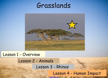
Grasslands Unit
This a SMART notebook file that forms a complete 4 lesson unit about grasslands, including, overview of grasslands, grassland animals, focus animal - Rhino and Human Impact on Grasslands.
This file includes links to videos, books, games and has an activity to complete at the end of each lesson to summarise knowledge learnt and can help with assessment. The activities at the end of each lesson are based around writing descriptions, requiring more detail and using less scaffolding towards the end
Subjects:
Grades:
2nd - 9th
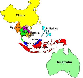
Southeast Asia Labeling Puzzle Map
this is a map of Southeast Asia for students to label. Teachers can scramble up the puzzle and students put it back together. This is a great activity to get students up out of their seats and do a hands-on activity with technology
Subjects:
Grades:
6th - 10th

La ropa - Qué llevo 5
ATTENTION! This is a Notebook file, intended for use on Smartboards.This thematic unit about clothing and weather will engage your students with real life tasks! The unit has 2 different performance tasks (aligned to the WL standards, which are included): a presentational writing task and an interpretive task. It reviews clothes in a fun way, presents several destinations in Guatemala, along with some geographical terms, so that students can plan a trip and pack according to the weather, and he
Subjects:
Grades:
4th - 7th
Types:
Showing 1-24 of 79 results


