125 results
Middle school geography resources for SMART Notebook
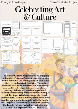
Family Culture Project: Activities, Resources, Google Slides and Lessons
The Family Culture Project offers an engaging exploration of students' ancestral roots, inviting them to delve into the rich tapestry of their family histories and original countries. Through interactive activities and research, elementary and middle school participants embark on a journey of discovery, celebrating cultural diversity and fostering a deeper understanding of their heritage. With hands-on projects and presentations, students not only learn about their own backgrounds but also gain
Subjects:
Grades:
1st - 8th
Types:
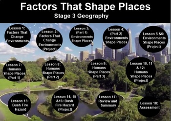
FACTORS THAT SHAPE PLACES- Stage 3 Geography (2 Terms inc. Proj.Bas.Lrn. + test)
My store- The Right Stuff, is primarily stocked with units which are used on the Smart Board. They are SMART NOTEBOOK files, and absolutely REQUIRE you to have this program available to you.This unit covers 2 full terms lesson material strictly adhering to the Australian Curriculum (NSW). You will find all information, worksheets, and web links included, as well as a written assessment. There is no answer sheet as answers are subjective to what students recall from the lessons.The outline is inc
Subjects:
Grades:
5th - 6th
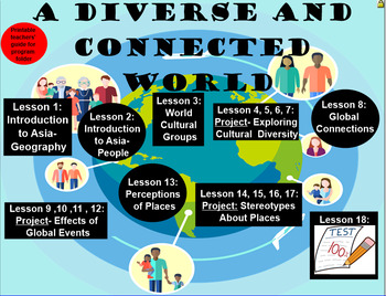
A Diverse and Connected World Two Terms’ Work- Geography, Stage 3
My store- The Right Stuff, is primarily stocked with units which are used on the Smart Board. They are SMART NOTEBOOK files, and absolutely REQUIRE you to have this program available to you.This unit covers 2 full terms lesson material strictly adhering to the Australian Curriculum (NSW). You will find all information, worksheets, and web links included, as well as a written assessment. There is no answer sheet as answers are subjective to what students recall from the lessons. Some links may re
Subjects:
Grades:
5th - 6th
All About Landforms - Complete SMART Notebook Smartboard Lesson
This HUGE lesson has everything you need to teach landforms to your students. It includes over 54 pages of interactivity, along with printable PDFs (embedded) for formative assessment, reinforcement, and extra practice. Tons of voting along with graphic organizers, activity containers, games, and online resources. 16 popular landforms are covered including: river, pond, glacier, mountain, volcano, plain, plateau, island, & more! Colorful & fun!
Be sure to follow my blog for tons of fr
Grades:
2nd - 6th
Longitude and Latitude SMART Notebook Activity
Students complete a SMARTboard activity using lines of longitude and latitude. I used this after showing students a clip about what longitude and latitude are in a station. These questions prompt students to use longitude and latitude to find states and continents. Students will need to use maps from an atlas to complete this activity.If you like this activity, check out my Acids and Bases Litmus Lab.Acids and Bases Lab♦ Interested in more of my RuthAnn Lane resources and products?Check out my w
Grades:
3rd - 6th
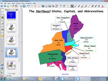
Northeast Region Map and Smartboard Activities
These Smartboard slides were created to help students who are studying the regions of the United States to learn the states, capitals and abbreviations. Students can label the maps. Also, the last slide focuses on key terms of the history, culture, geography, climate, agriculture, and manufactoring of this region.
Subjects:
Grades:
3rd - 6th
Types:
Also included in: REGIONS OF UNITED STATES SMART BOARD SLIDES *BUNDLE/ EDITABLE
Virginia Studies SMARTboard Lesson - VA Geography - VS.2
**Updated to the NEW Virginia SOLS (2016)**
This is a 26 page instructional SMART Board lesson that covers Virginia Studies SOLs VS.2 a,b,c - the entire Virginia Geography Unit. This lesson is full of interactive activities, video clips, websites, pictures and more!
This SMARTboard usually takes me about 2 -3 weeks to teach. It is aligned perfectly to my interactive notebook on this topic that is also listed here on TPT. You can find it here: https://www.teacherspayteachers.com/Product/Virgin
Grades:
3rd - 8th
Types:
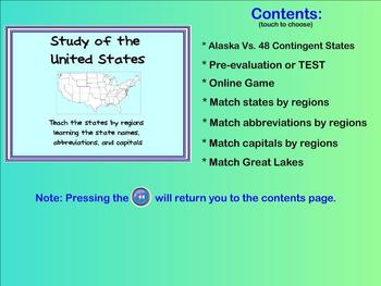
Learn the States - state names, capitals, abbreviations (Smartboard activities)
This product allows you to teach the different states within the United States in a FUN way!
Students are able to drag the states' names, capitals, or abbreviations to the appropriate location on the map. Correct answers will respond but incorrect answers will bounce back into the list. (Allows immediate evaluation of the students' knowledge of the material)
The SMARTboard activities teach/reinforce the states within different regions of the continent. By working with only a few states at a
Grades:
3rd - 6th
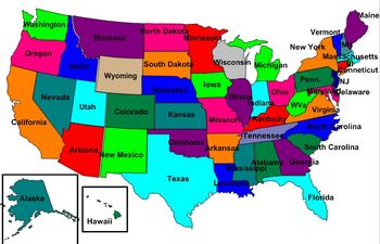
United States Labeling Puzzle Map
This is a map of the United States for students to label. Teachers can scramble up the puzzle and students put it back together. This is a great activity to get students up out of their seats and do a hands-on activity with technology
Subjects:
Grades:
6th - 10th
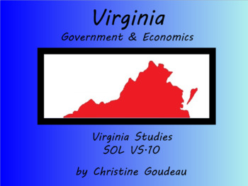
Virginia Studies SMARTboard Lesson - Virginia Government & Economy - SOL VS.10
This 16 page instructional SMARTboard unit lesson covers the topic of "Virginia Government and Geography." This lesson covers ALL of the Virginia SOLs VS.10 (updated with NEW SOLs in 2017). This lesson is fun, well organized, and will keep your students' attention! It has tons of pictures, video clips, and interactive parts. Use my SMARTboards in place of a textbook! My interactive notebooks (also featured on TPT) correspond perfectly with the SMARTboards and are a perfect way for your stud
Grades:
3rd - 9th
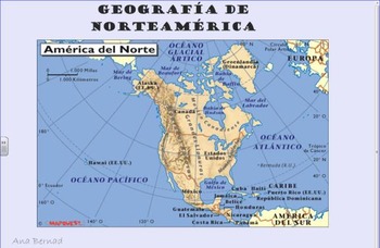
Geografia de America del Norte -North America
This thematic unit starts with a review of the basic concepts town/city, state, country and continents, with some speaking activities and a game. Then it focuses on North America (with an emphasis on Mexico and Central America) and its geography, covering vocabulary like ocean, coast, mountain, lake, river, peninsula, valley, jungle, desert, etc., with simple language and engaging activities. The pictures have been carefully selected for authenticity and are age appropriate. There are also link
Subjects:
Grades:
5th - 6th
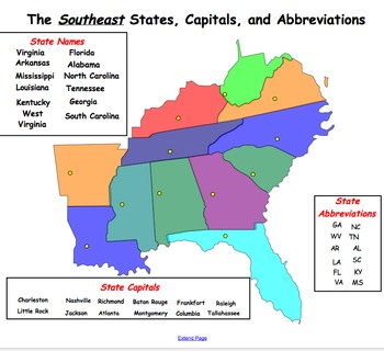
Southeast Region Map and Smartboard Activities
This Smartboard document contains slides of the Southeast region and includes labels for state names, capitals and abbreviations that can be dragged and dropped on the map. In addition, there is a slide which includes key words which can be dragged and dropped into the graphic organizer under the topics of geography, climate, agriculture, manufactoring, history and culture. This is a great activity for a social studies center or whole group instruction.
Subjects:
Grades:
2nd - 8th
Also included in: REGIONS OF UNITED STATES SMART BOARD SLIDES *BUNDLE/ EDITABLE
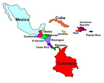
Central America and Caribbean Labeling Puzzle map
Map of Central America and Caribbean for students to label. Teachers can scramble up the puzzle and students put it back together. This is a great activity to get students up out of their seats and do a hands-on activity with technology
Subjects:
Grades:
6th - 10th

Geography- Europe Labeling Puzzle Map
Map of Europe for students to label. Teachers can scramble up the puzzle and students put it back together. This is a great activity to get students up out of their seats and do a hands-on activity with technology
Subjects:
Grades:
6th - 10th
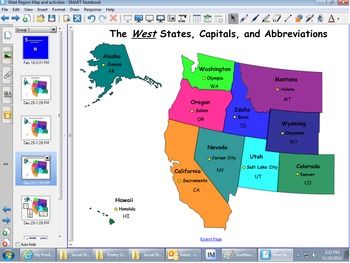
West Region Map & Smartboard Activities
This Smartboard document contains slies of the west region and includes labels for state names, capitals and abbreviations that can be dragged and dropped on the map. In addition, there is a slide which includes key words which can be dragged and dropped into the graphic organizer under the topics of geography, climate, agriculture, manufactoring, history and culture. This is a great activity for a social studies center or whole group instruction.
Subjects:
Grades:
2nd - 8th
Also included in: REGIONS OF UNITED STATES SMART BOARD SLIDES *BUNDLE/ EDITABLE
Virginia Geography & Regions Review SMARTboard Game
This is a SMARTboard Jeopardy style game to review the Viriginia 4th Grade Social Studies SOLs for Virginia Geography & Regions. Categories include: Virginia Regions, Virginia Waterways, Products, Industries, & Miscellaneous. This is a great way to end your study of this unit or to review for SOLs! It can be used after my Virginia Geography instructional SMARTboard lesson, also listed on Teachers Pay Teachers!
Grades:
3rd - 8th
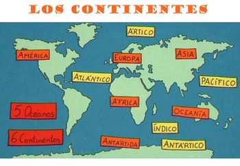
Los continentes - learning the continents and oceans in Spanish
This interactive unit is a great tool for content related FLES programs and Dual Language programs. It is full of fun activities and learning! The students will learn language related to the continents and oceans with carefully selected pictures, a song (along with a related worksheet), games, visuals, links to age appropriate videos, Smartboard activities and online activities. It includes a section about different families from around the world, a section about animals, and 4 attached workshee
Subjects:
Grades:
3rd - 7th
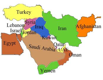
Middle East Labeling Puzzle map
Map of the Middle East for students to label. Teachers can scramble up the puzzle and students put it back together. This is a great activity to get students up out of their seats and do a hands-on activity with technology
Subjects:
Grades:
6th - 10th
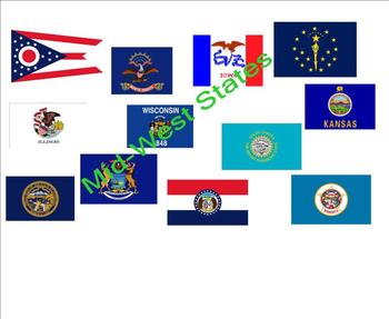
States and Capitals - Mid-West States
An interactive activity that provides your students a fun way to practice states, capitals, and abbreviations for the Mid-Western states. Great for social studies, center time, or mini-lessons. The Browns.
Grades:
2nd - 12th
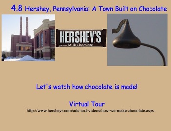
Chapter 4: The Northeast Region, Social Studies Alive! Grade 4
Social Studies Alive! Chapter 4: The Northeast Region - Grade 4Essential Questions:Why do we call the Northeast the "birthplace" of our nation?Why did our nation's first factories start here?What large cities are found in the Northeast?
Grades:
3rd - 6th
Types:

5 Themes of Geography Smartboard Lesson
This is a Smartboard activity that uses an interactive whiteboard to help the students become engaged in the lesson. The lesson focuses on the 5 themes of geography: location, place, movement, region, and human-environment interaction. This activity provides definitions, as well as examples of the themes of geography. Students are able to interact with the information throughout the entire lesson.
Subjects:
Grades:
4th - 9th
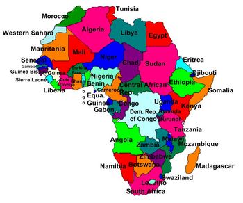
Geography- Africa Labeling Puzzle map
Map of Africa for students to label.
Teachers can scramble up the puzzle and students put it back together. This is a great activity to get students up out of their seats and do a hands-on activity with technology
Subjects:
Grades:
6th - 10th
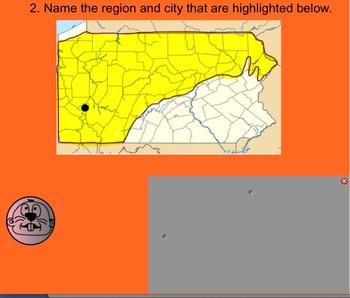
5 Regions of Pennsylvania Whack-a-Mole Review Game (SMARTboard)
This is a SMARTboard Whack-a-Mole review game focused on the 5 regions of Pennsylvania! Enjoy!
Subjects:
Grades:
4th - 6th
Types:
Where in the World? Latitude and Longitude: A SmartBoard Intro for Grades 3-6
The world is a vast place! Cartographers designed latitude and longitude coordinates to help identify the absolute location of a place on the Earth.
This 26 page SmartBoard presentation in designed for instructional purposes, and breaks down this abstract concept for younger learners to understand. It also includes two interactive activities at the end, allowing students to test out their new knowledge of latitude and longitude.
This presentation includes
* What is latitude?
* What is lo
Subjects:
Grades:
3rd - 6th
Showing 1-24 of 125 results


