28 results
Free geography resources for GATE
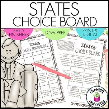
FREE States Choice Board Menu for Differentiation Enrichment and Early Finishers
Are you looking for an engaging, no-prep States Choice Board? Choice boards / menu boards / tic-tac-toe boards are excellent for differentiating your instruction for ALL students, including intervention and enrichment students! This choice board is perfect for reviewing and extending what you've taught in class. Printable and digital versions are both included, and it's ready to be used!What Is Included in This Resource?Teaching TipsChoice Board Folder CoversStudent Pages for Each Choice Board A
Grades:
2nd - 5th
Types:
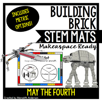
May the Fourth STEM Mats - STEM Center for Building Bricks
May the 4th be with you! These ARE the STEM mats you are looking for. If you are searching for a STEM / space themed resource for May the 4th, this set is out of this ✨world✨!STEM Mats are so easy to set up in your classroom! If you like these please check out the other available sets (below).What You'll Get⭐ Instructions and sample images⭐ 3 May the 4th STEM Mats ⭐ Recording sheet⭐ Metric options and two color themesLearn MoreFor a detailed explanation of how to use STEM mats, please visit this
Subjects:
Grades:
1st - 5th
Also included in: STEM Activities and Makerspace Tasks for the Whole Year
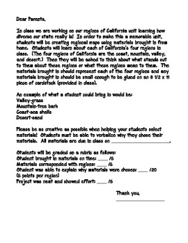
California Regions GATE Project
This is a culminating project for students after learning about the regions of California. It combines art and writing with GATE icons and allows students to make a personal connection to their home state. Students are asked to think about what each region of California means to them, then to bring in objects to be glued to a map that correspond to that region (i.e. sandpaper for the desert, pine needles for the mountains, etc.) Students will then complete a half page GATE sheet (glued to the
Subjects:
Grades:
3rd - 4th
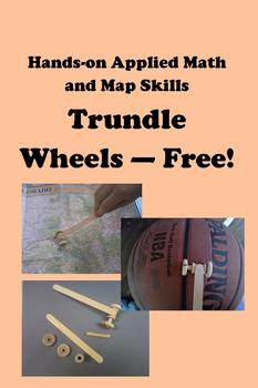
Trundle Wheels -- Free! Hands-on Applied Math and Map Skills
Trundle wheels are a simplified version of a surveyor’s wheel. In this basic student edition of the trundle wheel, students roll their own version of trundle wheels across all sorts of things. They work especially well to measure curved surfaces or for applying a map’s scale of miles on highways.
A bonus to using trundle wheels in the classroom is that students must apply math skills to convert their measurements from the revolutions of the trundle wheel to yards, feet, inches, meters, centim
Subjects:
Grades:
3rd - 8th
Types:
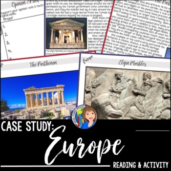
Europe Case Study - Who Owns the Elgin Marbles?
Are you looking for an extension or a GT activity for your unit on Europe? Use this discussion activity on the Elgin Marbles. Your students will read about the history of the Parthenon and the "theft" of the Elgin Marbles. After completing an Opinion/Proof Graphic Organizer, your students will debate who should own the statues from this World Heritage Site. This activity is perfect for practicing point of view and crafting an argument based on facts. With this resource, you will receive:-Goog
Grades:
6th - 9th
Types:
Also included in: GEOGRAPHY ACTIVITIES BUNDLE
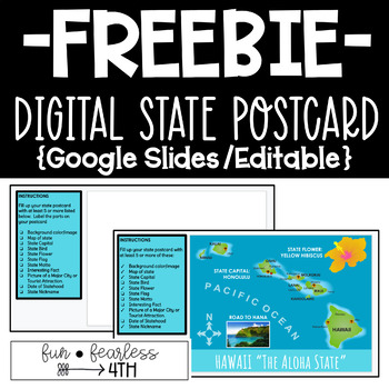
Digital State Postcard {Google Slides/Editable}
How to Use!Includes:Google Slide Blank Template with Student InstructionsGoogle Slide EXAMPLE I use Google Classroom as my online platform. If you are using the same, you would assign a copy of the blank file to each student. Then, you would assign the “Hawaii” example so students can VIEW file (but not edit). The instructions are EDITABLE, so you can adjust what you expect from students. This is perfect for Social Studies when students are learning about their home state or other states across
Grades:
3rd - 6th
Types:
9:14
Let's Draw a 13 Colonial Trade Map! (Imports - Exports)
Easy to follow directions, using right brain drawing techniques, showing how to draw a 13 Colonial Trade Map! (Imports - Exports)Visit my You Tube Channel: Patty Fernandez Artistfor over 1,000 FREE videos that integrates the Visual Arts, with other content areas you teach in a school day.Share my You Tube Channel: Patty Fernandez Artistwith your friends, school, and District. AND for sure Become a Subscriber!
Grades:
Not Grade Specific
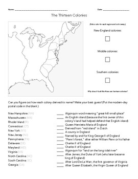
Thirteen (13) Colonies Name Origin Match-Up--Pairs, Solo, or Talk-Through in Cla
Fun for learning the origins of the names of the Thirteen Colonies--and a great chance to lightly talk through influences and chronology of settlement in a pleasant way. For instance, Maryland is named for Queen Henrietta Maria, a Catholic queen, which was fitting for a colony favorable for settlement by Catholics. Caroline/Carolina is the feminine version of "Charles," which many students probably don't know, but later helps make sense of terms like the "Carolingian Renaissance" in world histor
Subjects:
Grades:
6th - 9th
Types:
10:48
Let's Draw Diamond Head Oahu Hawaii (Landforms)
Easy to follow directions using right brain drawing techniques, showing how to draw Diamond Head Oahu Hawaii! (Landforms)Visit my You Tube Channel: Patty Fernandez Artistfor over 1,000 FREE videos that integrates the Visual Arts, with other content areas you teach in a school day.Share my You Tube Channel: Patty Fernandez Artistwith your friends, school, and District. AND for sure Become a Subscriber!
Subjects:
Grades:
Not Grade Specific
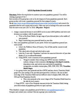
LEGO Population Pyramid Activity
Students engage in the geography classroom as they analyze data and create population pyramids. Students will observe the increase and decline of crude birth and death rates to explain the development of countries based on their populations. This activity is fun, engaging, and collaborative. Can be adapted and developed for the differentiated classroom.
Subjects:
Grades:
8th - 12th
Types:
CCSS:
12:25
Let's Draw Native American Tribal Regions (Part 2)
Easy to follow directions, using right brain drawing techniques, showing how to draw Native American Tribal Regions. (Part 2). These include: The Plains - The Southwest - Northwest / CA. - The Great Basin.Visit my You Tube Channel: Patty Fernandez Artistfor over 1,000 FREE videos that integrates the Visual Arts, with other content areas you teach in a school day.Share my You Tube Channel: Patty Fernandez Artistwith your friends, school, and District. AND for sure Become a Subscriber!
Grades:
Not Grade Specific
11:46
Let's Draw Native American Tribal Regions (Part1)
Easy to follow directions, using right brain drawing techniques, showing how to draw Native American Tribal Regions (Part 1). These are: Arctic-Sub Arctic - Northeast -Southeast.Visit my You Tube Channel: Patty Fernandez Artistfor over 1,000 FREE videos that integrates the Visual Arts, with other content areas you teach in a school day.Share my You Tube Channel: Patty Fernandez Artistwith your friends, school, and District. AND for sure Become a Subscriber!
Grades:
Not Grade Specific
8:27
Let's Draw US Map Region - Hawaiian Islands!
Easy to follow directions, using right brain drawing techniques, showing how to draw US Map Region - Hawaiian Islands!Visit my You Tube Channel: Patty Fernandez Artistfor over 1,000 FREE videos that integrates the Visual Arts, with other content areas you teach in a school day.Share my You Tube Channel: Patty Fernandez Artistwith your friends, school, and District. AND for sure Become a Subscriber!
Grades:
Not Grade Specific
8:04
Let's Draw US Map Region - Northeast!
Easy to follow directions, using right brain drawing techniques, showing how to draw US Map Region - Northeast!Visit my You Tube Channel: Patty Fernandez Artistfor over 1,000 FREE videos, that integrates the Visual Arts with other content areas you teach in a school day.Share my You Tube Channel: Patty Fernandez Artistwith your friends, school, and District. AND for sure Become a Subscriber!
Grades:
Not Grade Specific
10:36
Let's Draw Devil Tower! (Sacred Native American Landform)
Easy to follow directions, using right brain drawing techniques, showing how to draw Devil Tower Sacred Native American Landform!Visit my You Tube Channel: Patty Fernandez Artistfor over 1,000 FREE videos that integrates the Visual Arts, with other content areas you teach in a school day.Share my You Tube Channel: Patty Fernandez Artistwith your friends, school, and District. AND for sure Become a Subscriber!
Grades:
Not Grade Specific
10:12
Let's Draw US Map Regions! (Southeast)
Easy to follow directions, using right brain drawing techniques, showing how to draw US Map Regions! (Southeast)Visit my You Tube Channel: Patty Fernandez Artistfor over 1,000 FREE videos that integrates the Visual Arts, with other content areas you teach in a school day.Share my You Tube Channel: Patty Fernandez Artistwith your friends, school, and District. AND for sure Become a Subscriber!
Grades:
Not Grade Specific
7:20
Let's Draw US Map Regions - Southwest!
Easy to follow directions, using right brain drawing techniques, showing how to draw US Map Regions - Southwest!Visit my You Tube Channel: Patty Fernandez Artistfor over 1,000 Free videos that integrates the Visual Arts, with other content areas you teach in a school day.Share my You Tube Channel: Patty Fernandez Artistwith your friends, school, and District. AND for sure Become a Subscriber!
Grades:
Not Grade Specific
6:17
Let's Draw US Map Regions - Rocky Mountain!
Easy to follow directions, using right brain drawing techniques, showing how to draw US Map Regions - Rocky Mountain.Visit my You Tube Channel: Patty Fernandez Artistfor over 1,000 FREE videos that integrates the Visual Arts, with other content areas you teach in a school day.Share my You Tube Channel: Patty Fernandez Artistwith your friends, school, and District. AND for sure Become a Subscriber!
Grades:
Not Grade Specific
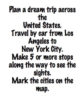
Cooperative math activity, includes math, geography and technology
In this cooperative math activity, students will create a dream trip across the United States. Using technology (iPods or iPads), students will determine distances between stops, learn geography, incorporate technology and have fun!
Subjects:
Grades:
3rd - 5th
7:37
Let's Draw US Map Regions - Pacific!
Easy to follow directions, using right brain drawing techniques, showing how to draw US Map regions - Pacific!Visit my You Tube Channel: Patty Fernandez Artistfor over 1,000 FREE videos that integrates the Visual Arts, with other content areas you teach in a school day.Share my You Tube Channel: Patty Fernandez Artistwith your friends, school, and District. AND for sure Become a Subscriber!
Grades:
Not Grade Specific
12:13
Let's Draw a Waterfall (Yosemite Falls)!
Easy to follow directions, using right brain drawing techniques, showing how to draw a Waterfall (Yosemite Falls)!Visit my You Tube Channel: Patty Fernandez Artistfor over 1,000 FREE videos that integrates the Visual Arts with other content areas you teach in a school day.Share my You Tube Channel: Patty Fernandez Artistwith your friends, school, and District. AND for sure Become a Subscriber!
Subjects:
Grades:
Not Grade Specific

Projects to do for a study of the Pacific States
Here is a list of possible projects that students can make or research in a study of the Pacific States. Students choose one based on what they feel are their strengths. Students can make models, dioramas, timelines, write stories, create graphs, etc. I usually give them one month to complete as we study a different region every month. States include California, Oregon, Washington, Alaska, and Hawaii. Projects are offered for all types of learners and all grade levels. I have a list of projects
Subjects:
Grades:
3rd - 6th
10:53
Let's Draw a CA Missions Map!
Easy to follow directions, using right brain drawing techniques, showing how to draw a Map of the CA Missions!Visit my You Tube Channel: Patty Fernandez Artist for over 1,000 FREE videos, that integrates the Visual Arts with other content areas you teach in a school day.Share my You Tube Channel: Patty Fernandez Artistwith your friends, school, and District. AND for sure Become a Subscriber!
Grades:
Not Grade Specific
13:37
Let's Draw a Map of a School!
Easy to follow directions, using right brain drawing techniques, showing how to draw a Map of a School!Visit my You Tube Channel: Patty Fernandez Artistfor over 500 FREE videos, that integrates the Visual Arts with other content areas you teach in a school day.Share my You Tube Channel: Patty Fernandez Artistwith your friends, school, and District. AND for sure Become a Subscriber!
Grades:
Not Grade Specific
Showing 1-24 of 28 results


