187 results
8th grade geography resources for Montessori
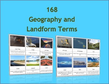
168 Geography and Landform Terms Flash Cards / 3 Part Montessori Cards
These cards align with most state standards and Classical Conversations Challenge A program. Additionally, these cards include terms specifically related to Hawaii's geography features such as windward, lava tube, etc. (Please see list below for a full list of terms.)The cards contained in this packet can be used as traditional flashcards or 3 Part Cards. The 3-Part Cards are Montessori inspired. Rote memorization can be difficult for children with dyslexia. The purpose of these cards is to as
Subjects:
Grades:
3rd - 12th
Also included in: Geography Terms Classical Conversations Aligned Bundle
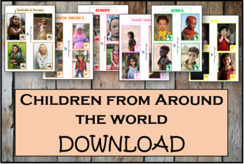
Children From Around The World - Montessori
As children work with these cards, they'll discover fascinating details about the lives and histories of people around the world. These Montessori-inspired children around the world cards will be a good fit to any classroom.This Montessori material is a part of peace education. The material consists of series of cards showing children of different nations, nationalities and races around the world. Each card contains a small map of the continent. There are 54 cards in the Download.
Subjects:
Grades:
PreK - 12th, Higher Education, Adult Education, Staff
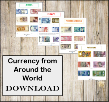
Currency from Around the World- Instant Download- Montessori
CURRENCY FROM AROUND THE WORLD INSTANT DOWNLOAD.There are 6 individual high resolution photos of different banknotes for countries around the world! This is a great addition to any Continent bag or Continent box. These photos are in regulations with the Department of Treasury for printing.
Subjects:
Grades:
PreK - 12th, Higher Education, Adult Education, Staff
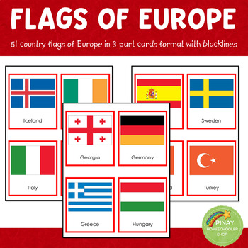
Montessori European Flags in 3 Part Cards and Blackline Masters
MONTESSORI EUROPE FLAGS 3 PART CARDSThis file contains 51 flags of Europe in red-bordered and no-bordered sets. This pack includes the following: ➥ 51 (3-part-card flags) with no border ➥ 51 (3-part-card flags) with red border ➥ 51 blackline master for coloring activities ➥ instruction on how to use the material⭐THIS IS PART OF A BUNDLE⭐This is part of the EUROPE IN A NUTSHELL learning pack. Please don't purchase if you own already own the said learning pack.NOTE: The flag set includes Euroa
Grades:
PreK - 12th
Types:
Also included in: Montessori Country Flags Bundle - COMPLETE
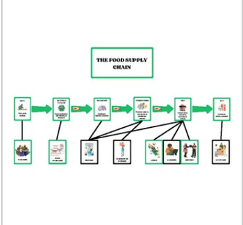
Supply Chain Chart & Cards (Montessori)
Supply chain work created to connect to interdependencies work. Includes the following: supply chain overview chartcards to sequence food supply chaincareer cards to connect workers to food chain sequencecards to sequence clothing supply chaincareer cards to connect workers to clothing chain sequencecontrol copies for both supply chain works diverse representation of workersYou will need to supply: short pieces of stringRecommendations:print cards on cardstockprint supply chain chart on larger p
Subjects:
Grades:
2nd - 8th
Types:
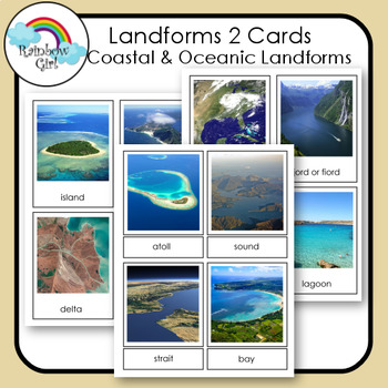
Landforms 2 Cards - Coastal & Oceanic Landforms
There are 20 Coastal & Oceanic Landform cards in this set. They include - island, peninsula, delta, beach, cove, cape, archipelago, isthmus, atoll, sound, strait, bay, gulf, fjord/fiord, estuary, lagoon, tidal pool, coral reef, sea cliff, sea cave.Be sure to check my other landform cards: Landforms 1Landforms 3 - Volcanic Landforms1. Print and use as flash cards / control cards.2. Print out cards and cut the word from the picture and use for matching word to picture.3. Print two sets and u
Subjects:
Grades:
K - 10th
Also included in: Landforms Bundle
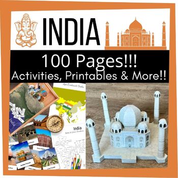
Cultural INDIA Country Study Asia Continent Activity Craft Bundle
Travel to the colorful country of INDIA through learning activities with this comprehensive hands-on activity bundle. Learn a general overview of this country with the educational India and flag poster, including a coloring sheet to color your own flag. Identify major historical events with the India history poster & timeline cards. Learn about some of the major landmarks of India with Montessori-inspired 3-part cards and map pinning work. Observe the country outline and learn the states and
Grades:
1st - 8th
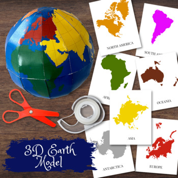
3D Earth Globe Model w/Montessori Colored Continents & Flashcards
Create a 3D Paper model of the earth with detailed outlines of the continents in Montessori colors. Exclusive design!! Comes with detailed instructions how to put the pieces together as well as flashcards to pair with the individual continents. Great activity to pair with both study of the continents as well as learning about space.
Subjects:
Grades:
PreK - 8th
Types:
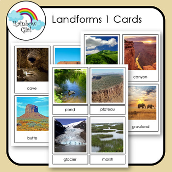
Landforms 1 Cards
There are 24 landform cards in this set. They include - desert, mountain, valley, plain, hills, canyon, forest, grassland, cave, mesa, butte, cliff, dune, oasis, river, lake, pond, plateau, glacier, marsh, swamp, creek/stream, waterfall, rapids.Be sure to check my other landform cards: Landforms 2 - Coastal & Oceanic LandformsLandforms 3 - Volcanic Landforms1. Print and use as flash cards / control cards.2. Print out cards and cut the word from the picture and use for matching word to pictu
Subjects:
Grades:
K - 10th
Also included in: Landforms Bundle
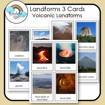
Volcanoes & Volcanic Landforms
There are 16 Volcanic Landform in this set. They include - caldera, crater lake, geyser, lava dome, lava flow, lava lake, lava plain/lava field, lava tube, fissure vent, volcanic plug, volcanic crater, volcanic cone, stratovolcano/composite volcano, shield, volcano, cinder cone volcano, volcano.Be sure to check my other landform cards: Landforms 1Landforms 2 - Coastal & Oceanic Landforms1. Print and use as flash cards / control cards.2. Print out cards and cut the word from the picture and u
Subjects:
Grades:
1st - 10th
Also included in: Landforms Bundle
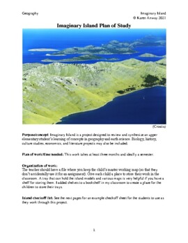
Montessori Imaginary Island Geography Capstone Project--an album
This series of 15 lessons guides children through the process of creating an imaginary island with a geographic and cultural history. The main purpose of these lessons is to provide an engaging and creative way to review concepts in earth science that lead to the formation of land forms. The multi-disciplinary approach also incorporates geography, biology, economics, world history and language arts in a creative work of art celebrating earth's history and our place on the planet. This project is
Subjects:
Grades:
4th - 8th
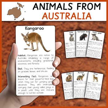
Australian Animals | Animals from Australia Informational Cards / Flashcards
This material contains a set of cards with Australian Animals. This set contains 15 high quality REAL images of animals thriving in the continent of Australia.All cards are structured as follows:Name of the AnimalReal photo of the animalHabitatDietInteresting factThese are the animals you get in this printable material:KoalaDingoBandicootTasmanian devilDugongWombatKangarooSugar gliderQuokkaEmuNumbatWallabyQuollGalahEastern pygmy possum
Subjects:
Grades:
1st - 8th
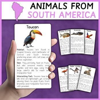
South American Animals | Animals from South America | Flashcards | Informational
This material contains a set of cards with Animals of South America. This set contains 27 high quality REAL images of animals thriving in the continent of South America.All cards are structured as follows:Name of the AnimalReal photo of the animalHabitatDietInteresting factThese are the animals you get in this printable material:ToucanAmazon PiranhaMacawAnacondaAlpacaCapybaraScarlet IbisCougarHarpy eagleSpider monkeySlothGuinea PigJaguarAnteaterOpossumGreen IguanaEmperor TamarinPink river dolphi
Subjects:
Grades:
1st - 8th
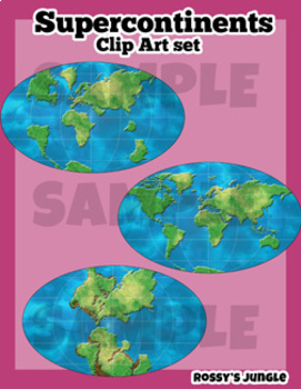
Supercontinents Clip Art Set
This is a set that includes the continents over time, detailed and suited for older students.Includes both color and line art PNG files.Perfect for projects about geology, paleontology, dinosaurs, Pangaea, continental drifts, etc. Detailed world maps:-1 permian- 1 triassic-1 jurassic-1 cretaceous-1 present day
Subjects:
Grades:
6th - 12th, Higher Education, Adult Education
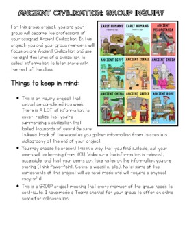
Ancient Civilization: Group Inquiry Project
A multi-modal approach to learning about Ancient Civilizations. Designed with the British Columbia Grade 7 Curriculum in mind, however, can be adapted to suit your Ancient Civilization teaching needs. This is an INQUIRY project which puts students at the centre of their own research; please note, readings are not provided to help students answer questions. MULTIPLE probing questions have been provided to help students with their researching. A rubric is included as well. Anticipated completion t
Grades:
6th - 8th
Types:
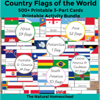
500+ Country Flags of the World Printable 3-Part Cards MEGA Bundle
This flags world pictures bundle includes 252 flags of the world! Of course, they are not all the flags of the world, but they are so many to learn and they offer a variety because they are from the 7 continents of the world.5 North America countries flags10 South America flags59 Africa flags 3-Part Cards61 Europe flags24 Australia and Oceania flags1 Antarctica flag40 Central America and Caribbean flags52 Asia flags, including Eurasia and the Middle East
Subjects:
Grades:
PreK - 12th, Higher Education, Adult Education
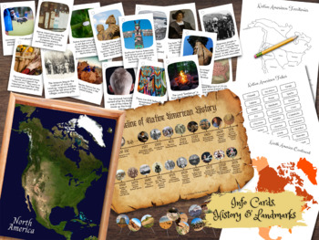
NATIVE AMERICAN Indian Map Tribe & Landmark Geography Pin Activity & Flash Cards
Learn about the major territories of the Native American Indians as well as historic landmarks around North America with map pinning activity. Learn interesting facts about Native Americans with flashcards. Includes 9 pages of digital resources. *These resources are also included in the NATIVE America Unit Study Bundle.
Subjects:
Grades:
K - 8th
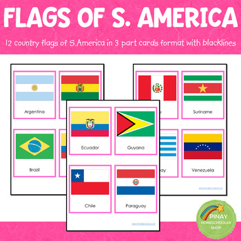
South America Flags Montessori 3 Part Cards
MONTESSORI SOUTH AMERICA FLAGS 3 PART CARDSThis file contains 12 flags of South America in pink-bordered and no-bordered sets. This pack includes the following: ➥ 12 (3-part-card flags) with no border ➥ 12 (3-part-card flags) with red border ➥ 12 blackline master for coloring activities ➥ instruction on how to use the material2023 UPDATE:Added a new version of the card: flag and map in one cardAdded 12 simple country information cards to match the flag (a more detailed version here)Added 12 f
Subjects:
Grades:
PreK - 12th
Types:
Also included in: Montessori Country Flags Bundle - COMPLETE
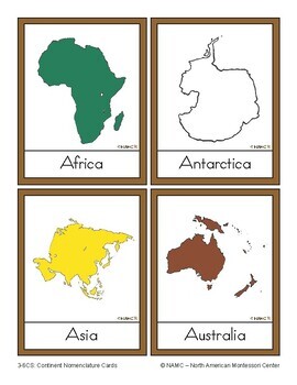
Montessori Continents - Three Part Cards
These 7 Montessori three part continents are ideal for enriching vocabulary and cultivating a global perspective with our Montessori Continent Three-Part Cards Set—a professional-grade resource tailored to inspire a lifelong passion for geography and cultural understanding in learners of all ages. Ideal for educators seeking to enrich their classrooms, homeschooling families dedicated to comprehensive learning, or parents fostering exploration at home, our Continent Three-Part Cards Set serves a
Subjects:
Grades:
PreK - 8th, Staff
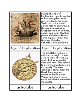
Navigational Tools During the Age of Exploration - Three/Four Part Cards
This PDF can be used to make a set of three/four part cards that can be used to teach students about the different navigational tools people used during the Age of Exploration. Each tool has a control card (word and picture), a word card, a picture card, and an information card. Tools/topics included are: Age of Exploration, astrolabe, quadrant, cross-staff, back-staff, and magnetic compass.To prolong the life of this material, cards should be printed onto card stock, cut, and laminated prior to
Grades:
1st - 8th
Types:
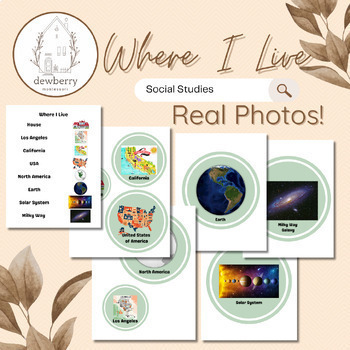
Where I Live PDF file and Canva Editable Template
This is a fun flip book with real photos that helps students learn where they live - large scale to small scale. To assemble, print all pages, cut out each circle, laminate, layer, (largest on the bottom), hole punch with a ribbon or a single ring binder. The PDF file includes the city, Los Angeles but anyone can edit the file via Canva template.Enjoy!
Subjects:
Grades:
PreK - 8th
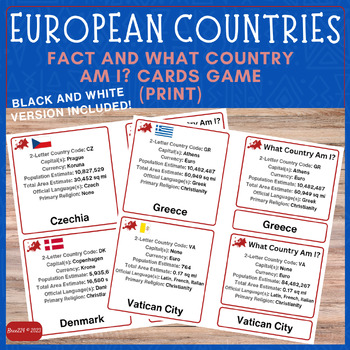
Continent Study: Countries of Europe Facts & What Country Am I? Match Card GAME
This is a zip file that contains two files both in pdf format. Within the file you will find detailed instructions for one way of presenting the materials as well as a two versions of a GAME to play. This file is geared toward 1st-5th grade but is versatile and can easily be used in middle school and high school grade levels as a quick review game or as flashcards.Black and White (labeled B&W) version with no flags is included for those who can't print in color.The country names are in print
Grades:
1st - 12th
Types:
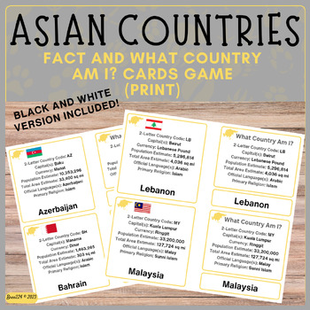
Continent Study: Countries of Asia Facts & What Country Am I? Match Card GAME
This is a zip file that contains two files both in pdf format. Within the file you will find detailed instructions for one way of presenting the materials as well as a two versions of a GAME to play. This file is geared toward 1st-5th grade but is versatile and can easily be used in middle school and high school grade levels as a quick review game or as flashcards.Black and White (labeled B&W) version with no flags included for those who can't print in colorThe country names are in print.The
Grades:
1st - 12th
Types:
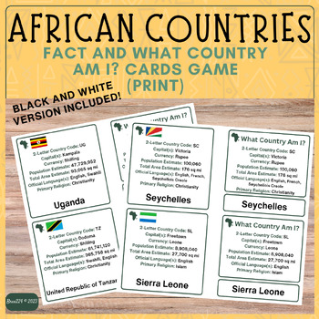
Continent Study: Countries of Africa Facts & What Country Am I? Match Card GAME
This is a zip file that contains two files both in pdf format. Within the files you will find detailed instructions for one way of presenting the materials as well as a two versions of a GAME to play. This file is geared toward 1st-5th grade but is versatile and can easily be used in middle school and high school grade levels as a quick review game.Black and White (labeled B&W) version with no flags included for those who can't print in color.The country names are in print.The file includes:
Grades:
1st - 12th
Types:
Showing 1-24 of 187 results


